The first hour of this hike was under heavy rain – downpours are common on Dartmoor. But if you want to hike in Britain, you cannot afford to let the threat of rain halt your plans, or you won’t get very far. It’s best to come prepared with wet-weather gear: a decent coat, appropriate trousers, and waterproof shoes or hiking boots.
Fortuitously, large parts of this walk were under the cover of trees, reducing the impact of the rain. It also means this route is suitable for those days when a downpour is forecasted, and you still want to get out and about.
Setting off in heavy rain
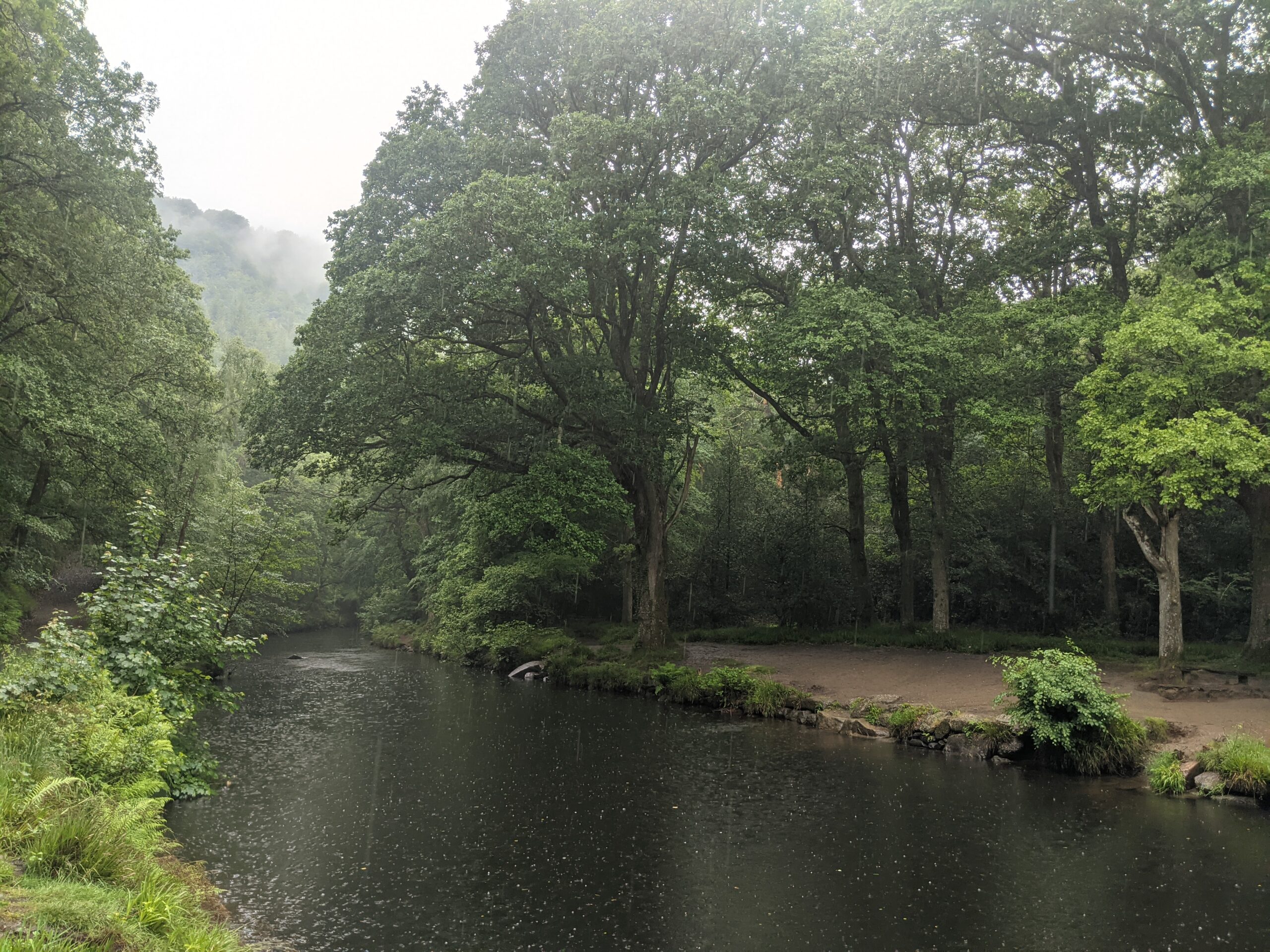
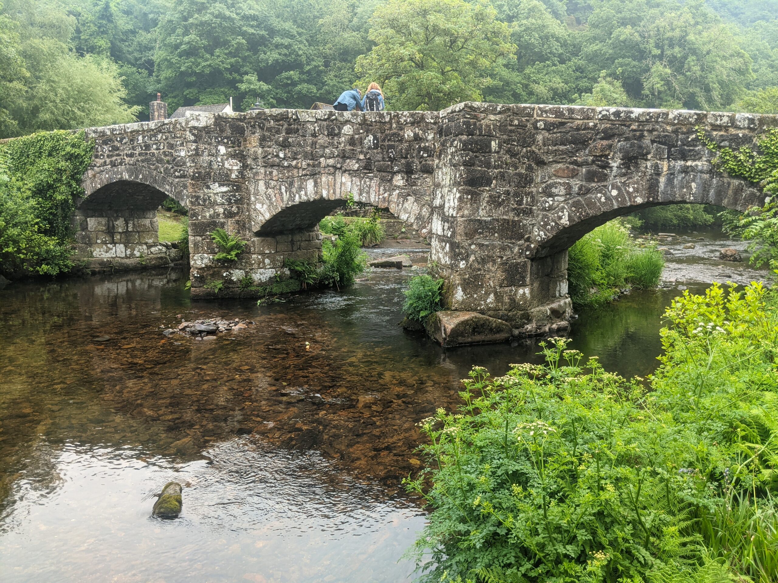
There are many possible starting points for this route. We set off from Fingle Bridge, a quant stone bridge built over the River Teign. After crossing, you can head east or west, as the route is circular. We headed west, towards Castle Drogo.
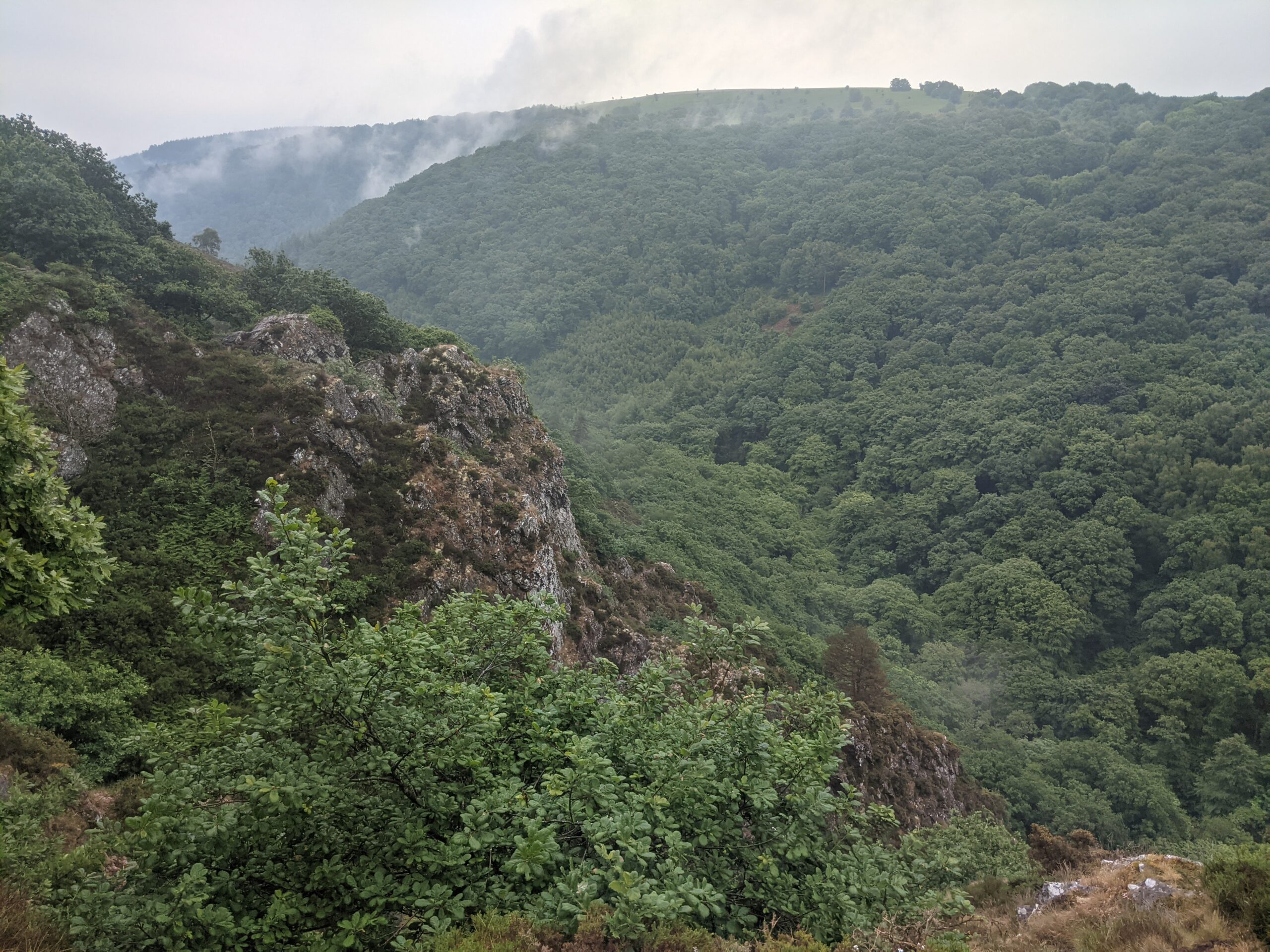
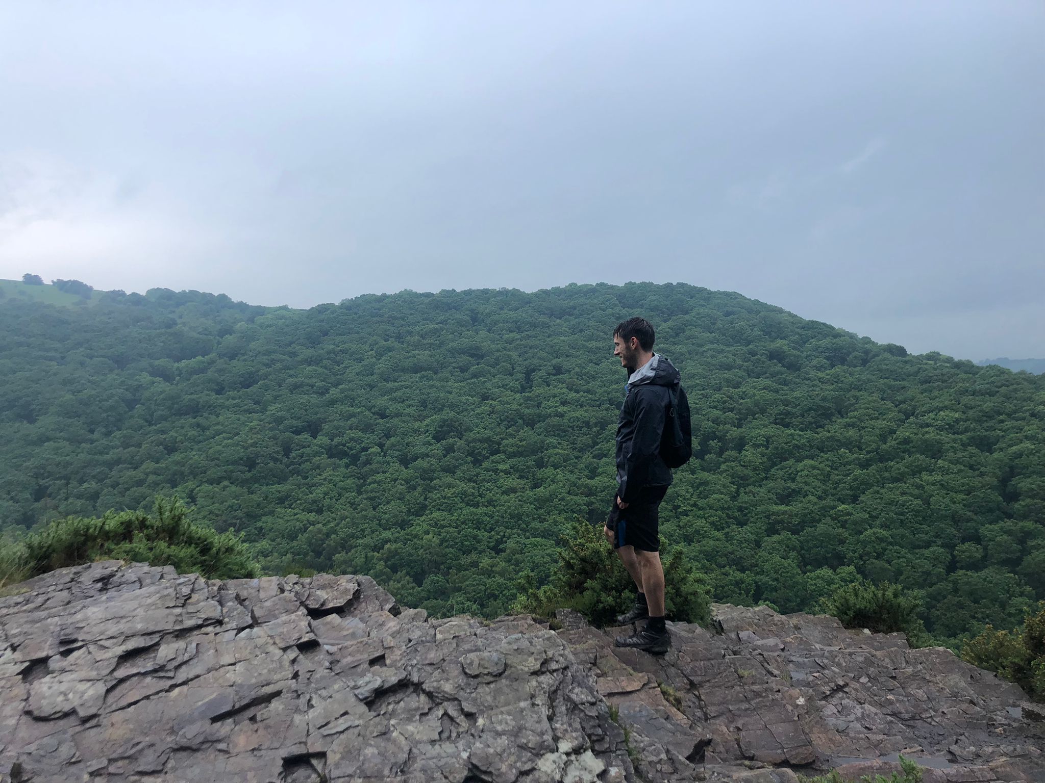
The path climbs gradually upwards, through woodland, with a few steep inclines. As the trail reaches a ridge, the trees subside and are replaced by ferns. Here, the rain halted. And as the view opened, it displayed a wooded hillside opposite, with a valley below separating us from it. The woods looked completely undisturbed – a rare sighting of untouched nature in England. With the low-lying fog hanging over the trees, it almost resembled a rainforest or jungle in an exotic, faraway land. The cold and damp quickly brought me back to reality.
Overlooking the valley
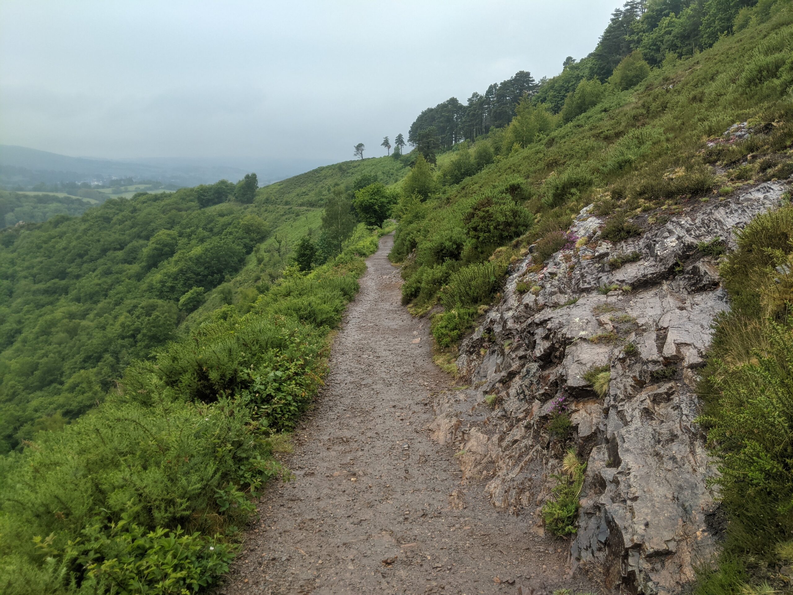
The trail
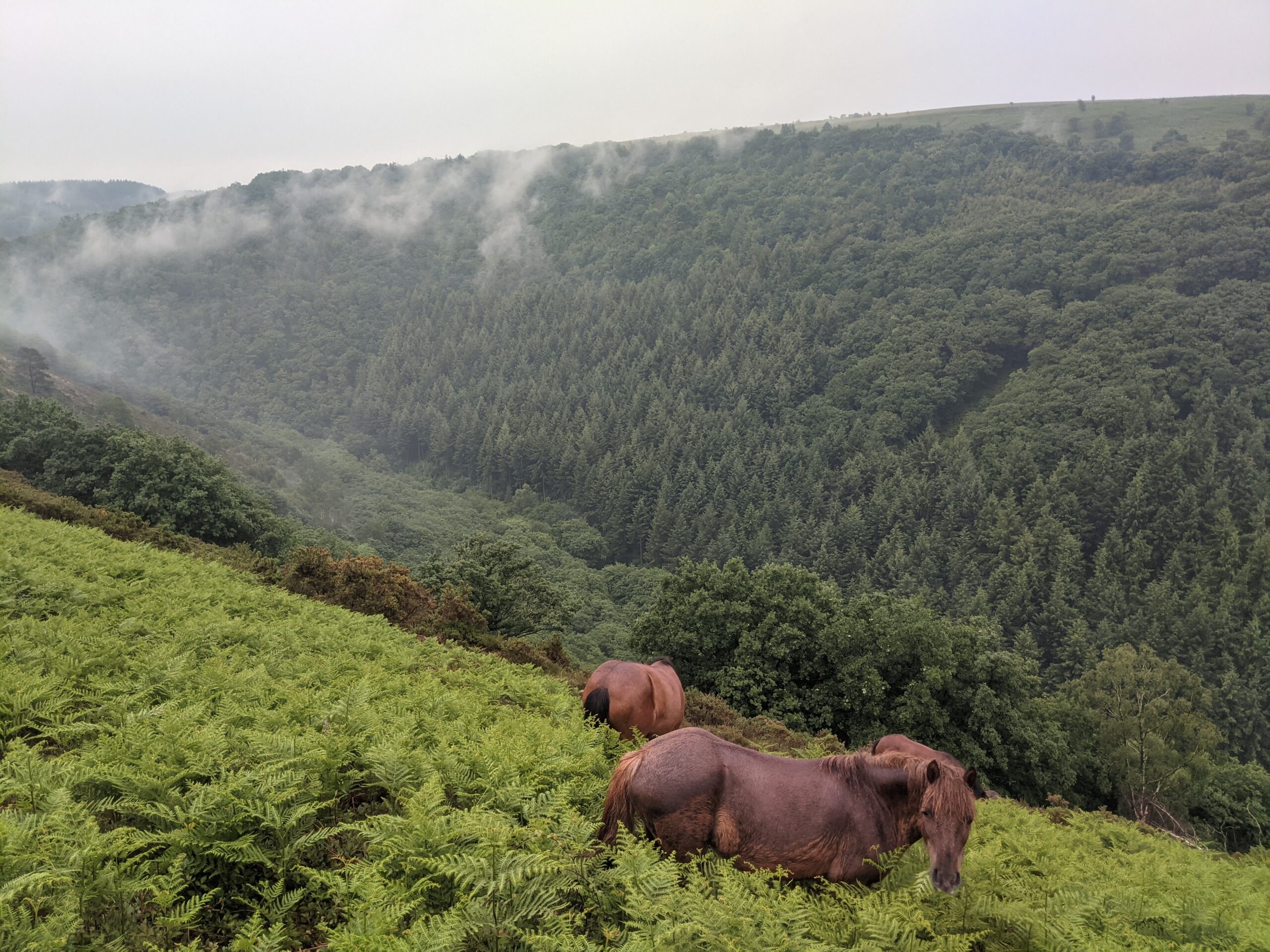
The trail bends round, above the ferns, peering over the valley. While walking we had, what seems to be common on Dartmoor, a close encounter with wild ponies. The magnificent beasts were feeding gracefully on the slopes, not far from the path.
On this loop, the trail turns back to the direction we came from. At first it was a short, sharp descent, followed by a more gradual decline back to the bridge. I was able to stop and take a photo of the bridge the second time we passed it, as the rain had subsided.
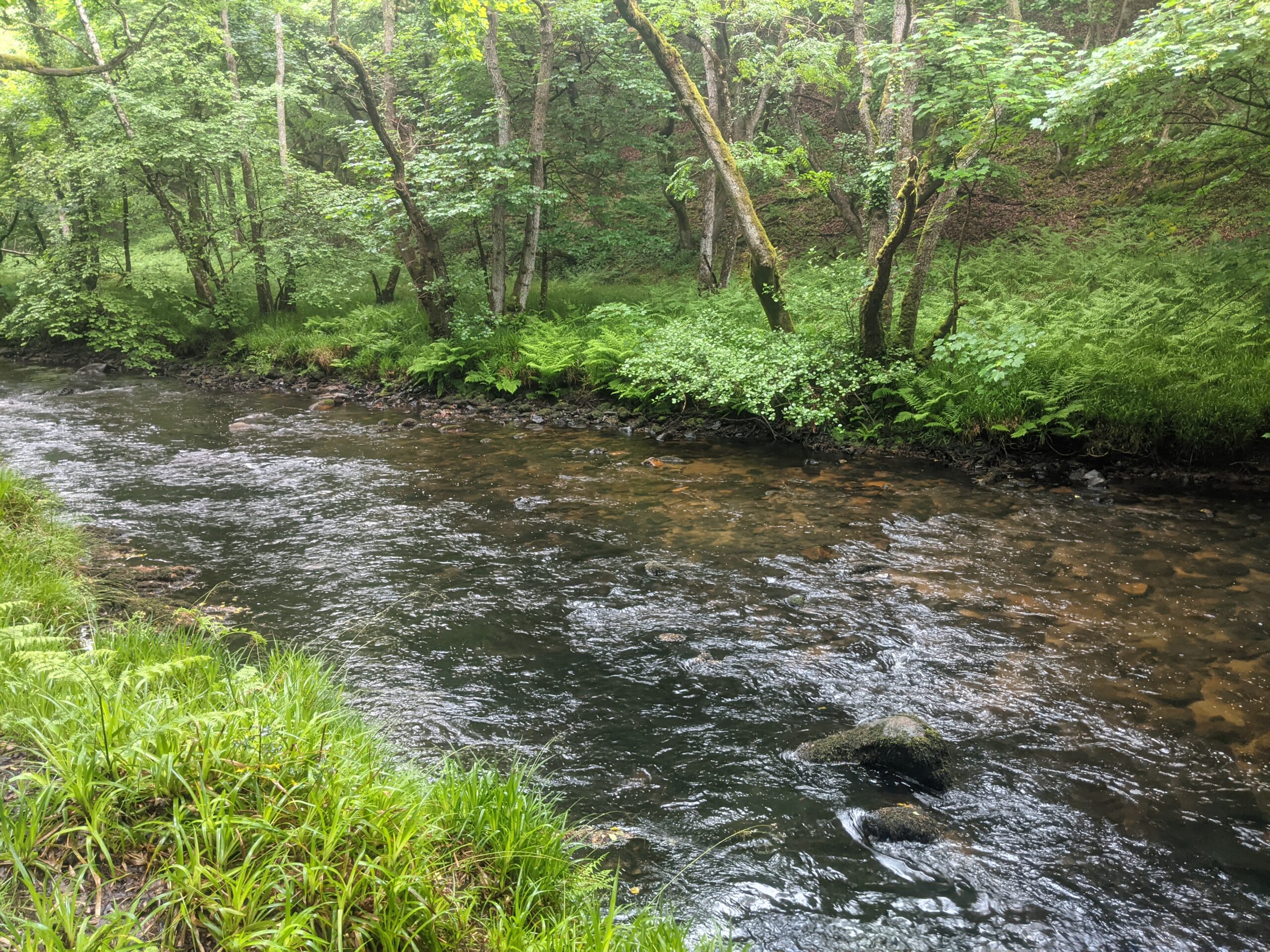
Beyond the starting point, heading east this time, the path enters a much larger wood. The trees are extremely tall, towering high above us as we passed underneath, walking beside the river. With the protection of the forest ceiling, and a few conveniently positioned benches by the water’s edge, it was a nice place to break for lunch.
Dartmoor Pony
The Bridge
While following the river, the walk was gentle and easy, until we reached the loop on the eastern side. As the path began to turn back on itself again, it becomes steeper, winding between the woods on either side. It is easy to become lost here, as we did, as there are several different trails to take.
With the help of GPS, its relatively simple to ensure you head in the right direction at least. It could be argued that the over reliance on such technology may also have contributed to a lack of basic orienteering skills – but that’s a debate for another day.
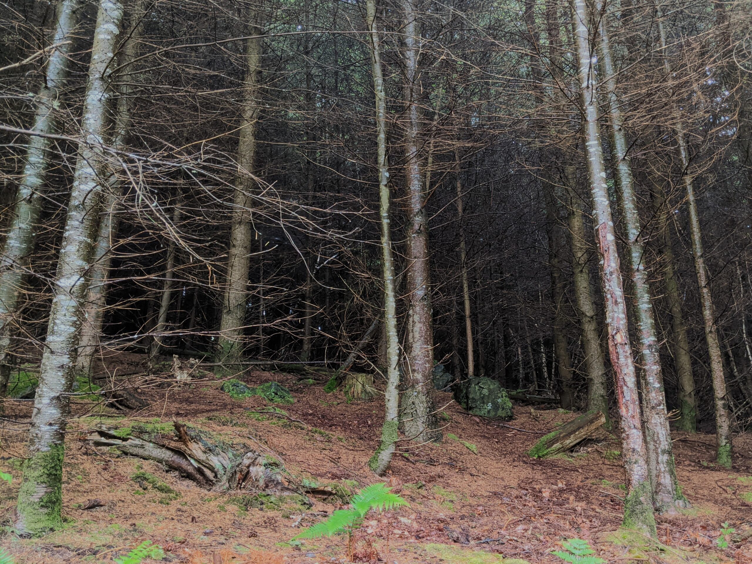
We found our path again fairly quickly, zig-zagging up hills and past deep, dark woods. The trees looked so dark in the centre you could become completely hidden within them, or even lost, if you went in without GPS (or a stack of breadcrumbs).
The path follows the river
Even Hansel and Gretel would struggle in here
Walking higher still, reaching the sight of an ancient hillfort, another opening reveals the surrounding scenery. This is the start of the end – where the trail begins to wind back down to the river’s level – and back to the bridge.
The walk totalled ten and a half miles, with a fair number of inclines, and so requires a good level of fitness to complete it. There are plenty of shorter (and longer) alternatives, for example, by only doing one side of the loop from the bridge. So, it is welcoming for all abilities.
While it is not as wild as some of the trails on the moors, it highlights the variety Dartmoor has to offer. It is peaceful by the woods and river, offering the chance to relax, enjoy some great views, as well as opportunities to explore (and get lost in) the woods.