Distance point to point: 20 miles (32km). Total elevation gain: 1,600m.
Booking ahead is needed at peak times, for the huts and campsites.
The trail
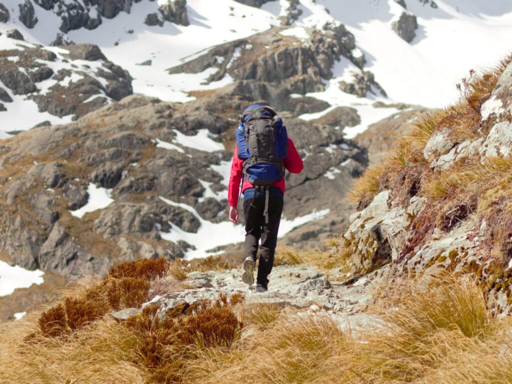
This is it, my first ‘proper hike’. It wasn’t my first long walk and wasn’t my first time on a hiking trail. But it felt like a proper hike (don’t ask me to define ‘proper’) – probably because of the oversized backpack I was carrying. The plan to stay in a cabin overnight meant bringing food and sleeping gear. That was all new, and made it feel like my first challenging hike.
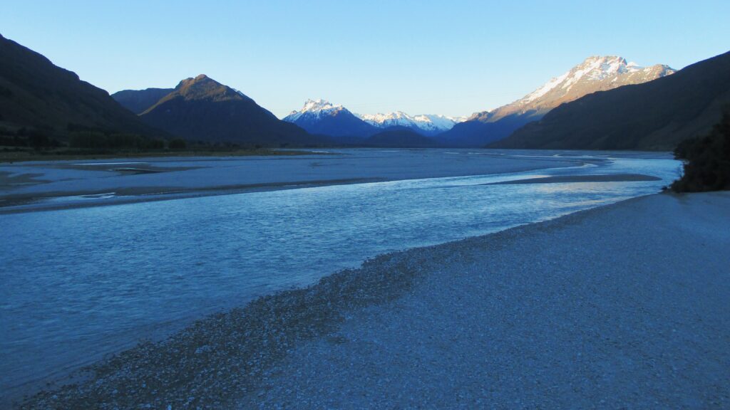
Routeburn is a well-beaten path on the South Island of New Zealand, between Queenstown and Milford Sound. It’s generally completed as a two or three-day hike, starting on either side of the mountain range. Completing the linear walk means you will need to find a way to return to your starting point – through a pre-arranged ride or flagging down a passer-by. Although I didn’t do that on this occasion, it had been easy enough to hitchhike in New Zealand on other occasions. I even picked up a few when I was driving around.
I wasn't used to hiking with a pack like that, and I felt it after
The build-up
Seeing plenty of cloud and patches of rain, the decision was made to wait a couple of days for the weather to clear up. The weather changes often, and quickly, in high elevation. It’s as important to pack for all weather, as it is to keep an eye on potential danger. Expect cloud, but heavy cloud, the threat of rain, hail or snow, probably isn’t worth a risk when up high.
Fortunately, there’s a lot to see in the area. Including a view of the ‘Misty Mountains’ from the hike up to the disused Invincible Gold Mine – a short, steep hike to get a taste for the views, as well as the hiking conditions. After waiting a couple days, the lingering clouds were no longer enough to put off the walk – and so it begun.
View of the misty mountains from the mine
Approaching Routeburn from Glenorchy
The start
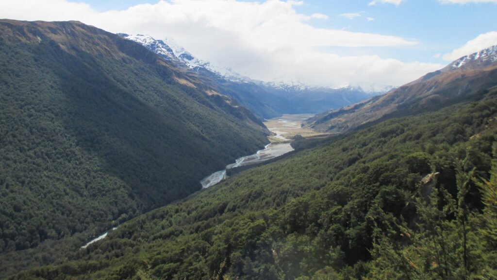
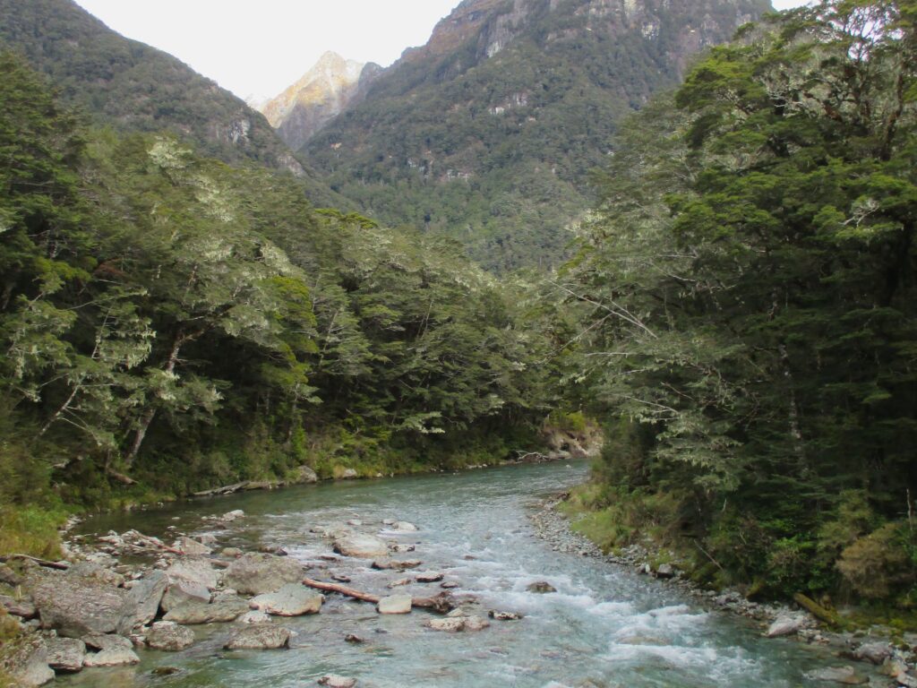
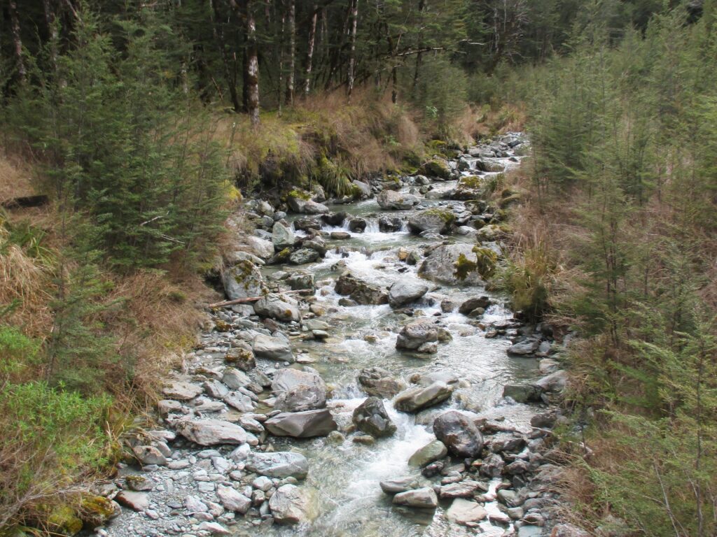
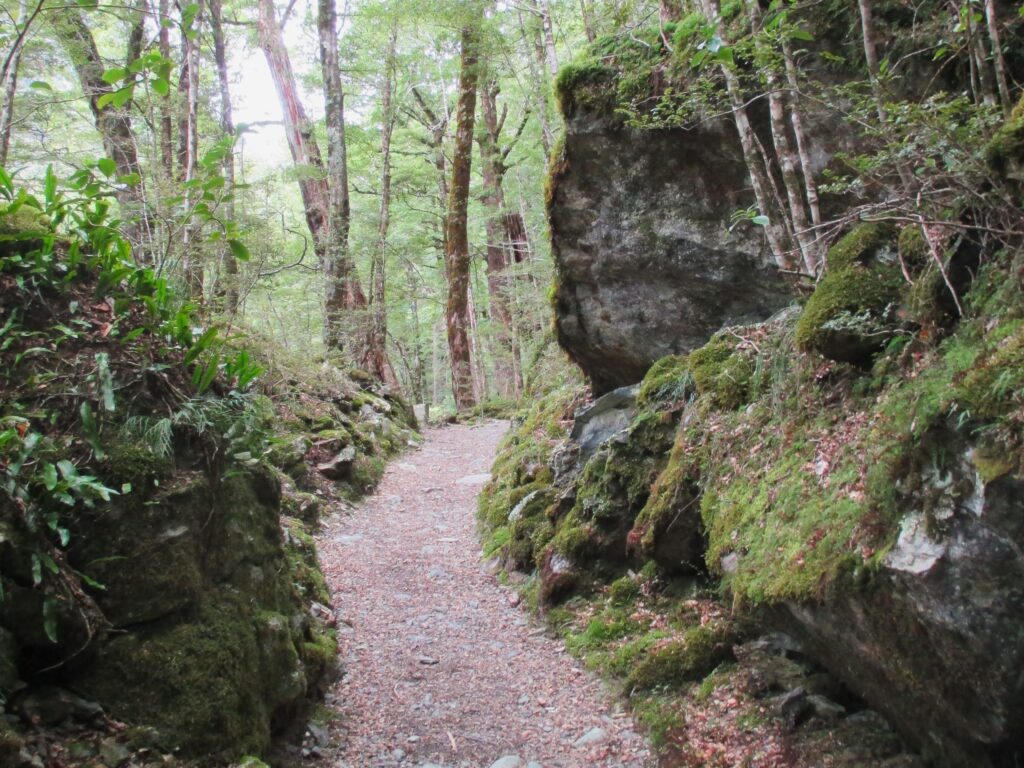
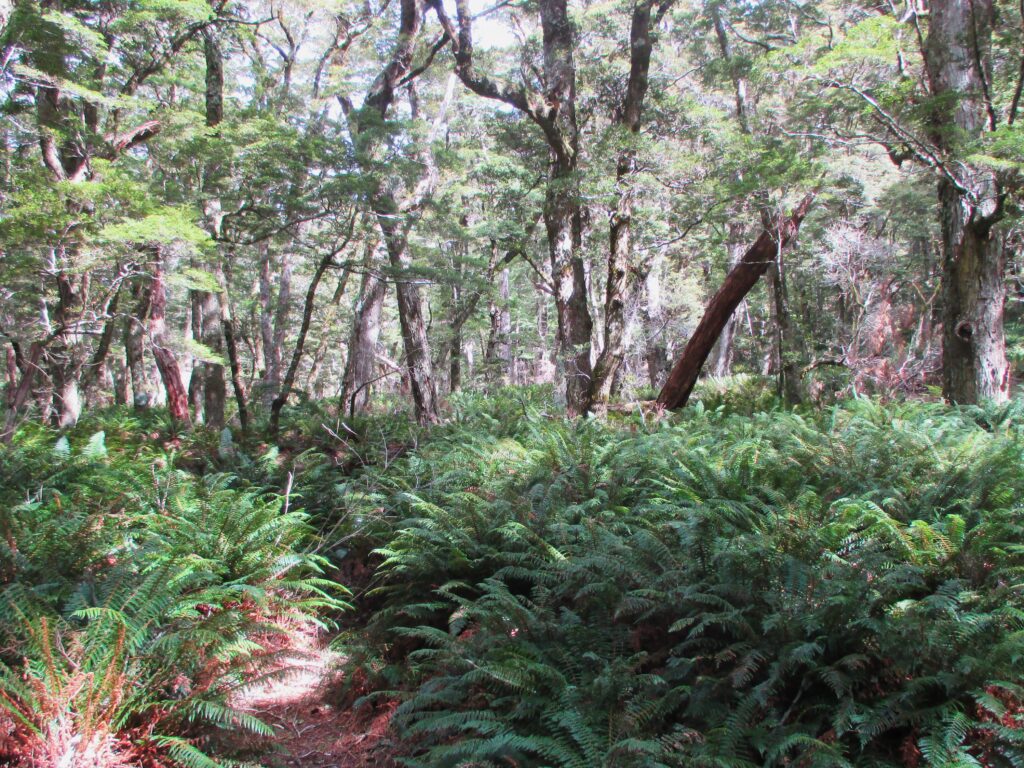
The hike at on the Queenstown side of the mountain begins near Glenorchy, at a dedicated car park for the hike. The start of the walk is a relatively steady incline through the tall trees, clearly marked trails between a mossy forest bed, with the river running alongside you.
At times, you can see the water deep down in a gorge below, and at other times, the river runs alongside you, just a few metres from the trail. There are several bridge crossings over the fast-flowing water.
Crossing the bridge onto the start of the trail
The river that follows the trail
On the track
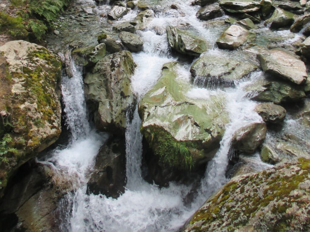
One of the waterfalls
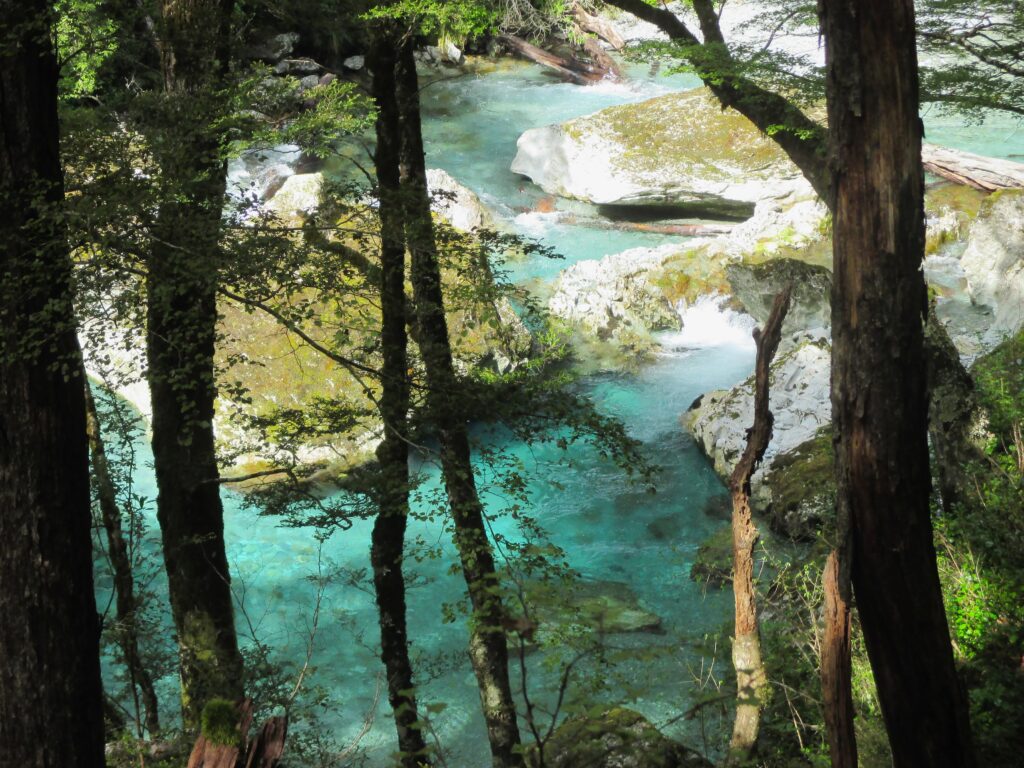
A glimpse of the bright blue river
Through the trees
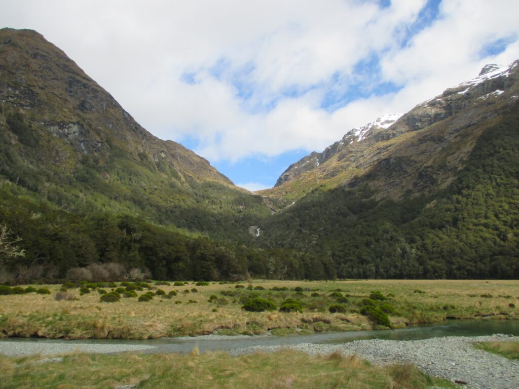
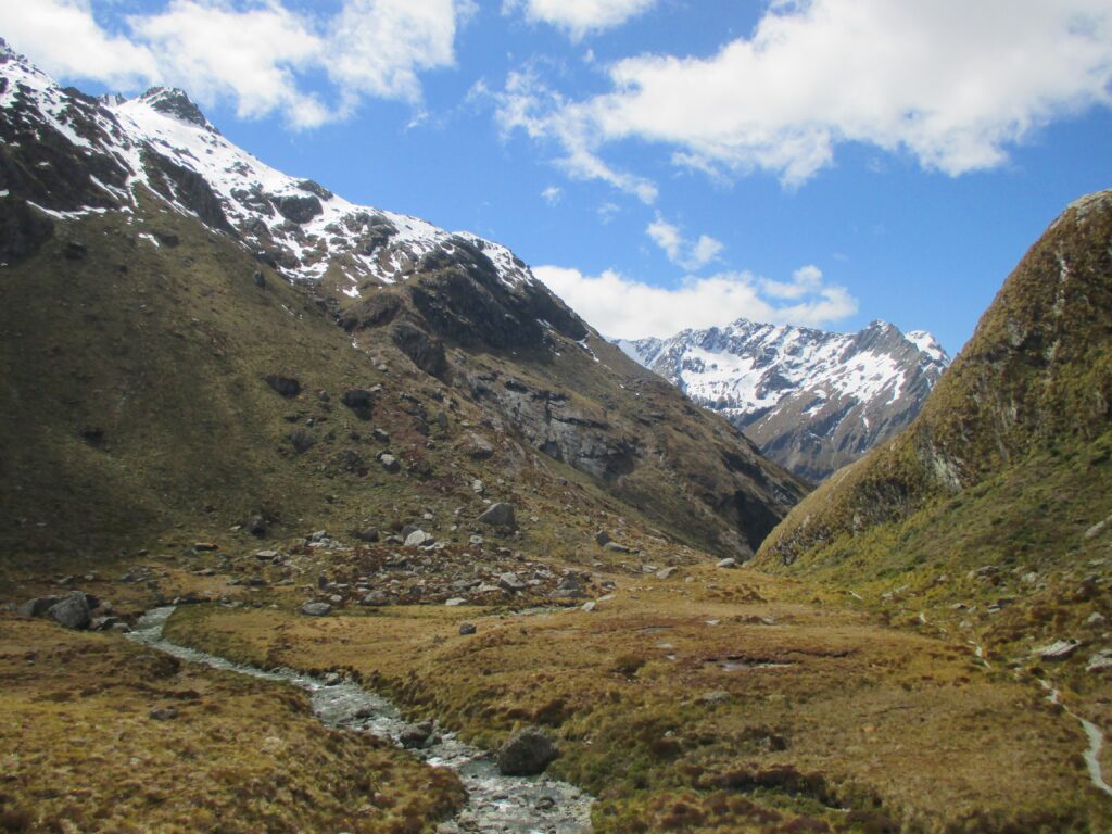
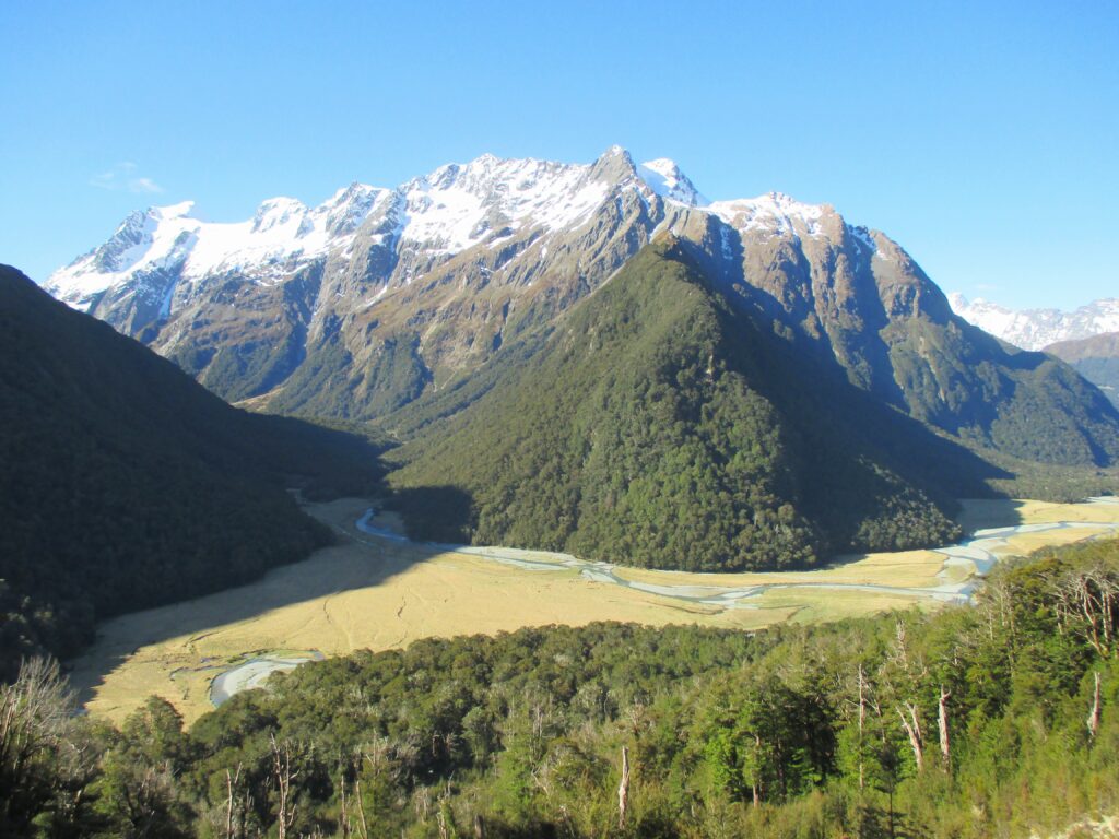
Routeburn Flats
After 90 minutes or so, depending on your pace, you will reach Routeburn Flats. This is where the forest opens up to wide, spacious plains; tall grass, divided by the stream, and imposing mountains in the background. Now, you are truly in Lord of the Rings territory.
This provides the clearest realisation yet of why Routeburn is so popular; the grand landscape, with a sight of the mountain range you will climb up to. Mesmerised by the view, it’s easy to forget at this point the inevitable struggle in reaching the heights ahead of you.
The plains of Routeburn
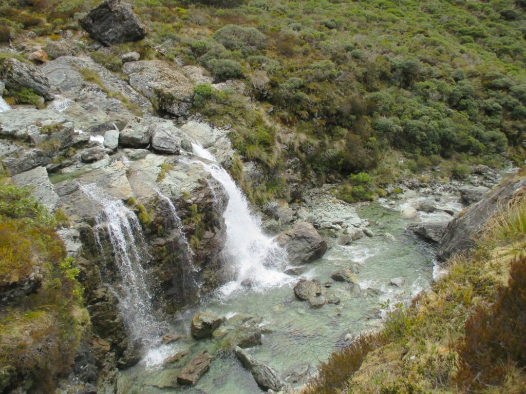
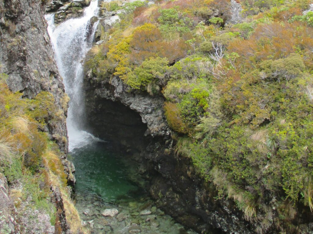
Waterfall
Past the plains the terrain becomes a little rocky, though the trail stays clear. It’s a steeper climb up the mountain side, with the occasional waterfall and peak at the sights below to raise motivation levels, as your legs face a stronger test. Aside from the those with vertigo – who will have to ignore the steep drop – you’ll be treated to an increasingly elevated viewpoint over the valley. You can make it to the next hut within an hour, but the incline makes this part tougher.
Before the large waterfall sits a rather disappointing large building complex, presumably to house the crowds the hike can bring, somewhat spoiling this otherwise pristine escape into the New Zealand wilderness. With the huts behind you though, the waterfall is a perfect place to stop for photos, food, and time to take in that view.
The falls from above
Another section of Routeburn Falls
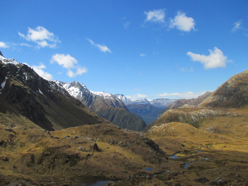
In Alpine territory
Leaving the falls behind, you face another, more gruelling climb. The landscape changes very suddenly here, as the trees are all but gone, replaced by scrubland, and sometimes bare, rocky ground – now resembling alpine terrain. And it no longer felt as if the trail was following the side of the mountains, but up into the mountain tops themselves. The peaks were no longer distant and mystical, instead, very real, and very intimidating.
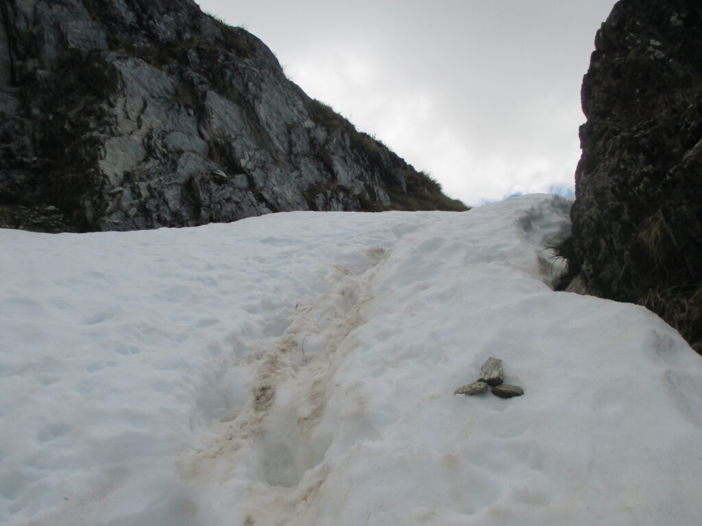
The temperature drops, too. Walking keeps you warm, especially with the sun out. However, pausing for just a short while should let you know you’re in the upper echelons of the track. The snow on the ground in mid-October served as a good reminder. Even if you haven’t packed gloves, and the chill is sinking in to your more exposed and thinly skinned extremities, a snowball fight is obligatory (play safe on the mountains).
The alpine terrain past Routeburn Falls
The reverse view halfway to Lake Harris
The first sight of the lake
Snow on the trail
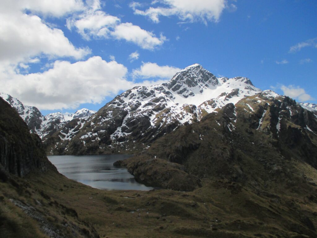
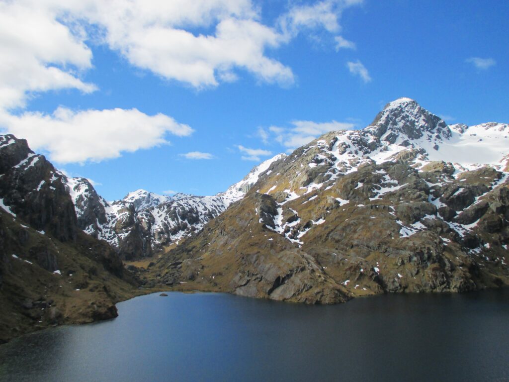
Lake Harris
The reward
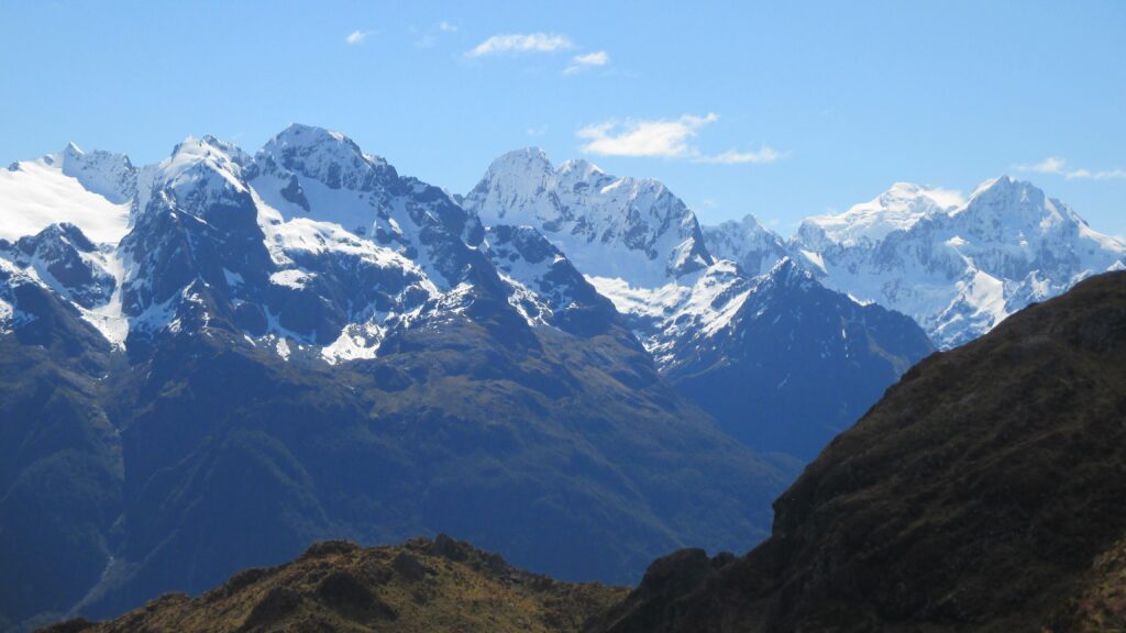
The trail takes you alongside the side of the lake, higher into the craggy mountains. And then, around the corner, reveals the most majestic view of the hike, a panoramic picture of the neighbouring mountain range in the distance. The mountains opposite don’t immediately appear to be a much different in height, but the jagged snow-covered peaks suggest they are much higher.
Having come from the plains below only a couple of hours early, I was now vividly aware of the possibilities hiking offered. In that moment I was simply amazed, lost in my gaze, appreciate of what I could see.
The view
And back again
It was here where it was decided, rather than stay the night at Lake Mackenzie, to turn and return to the vehicle. Disappointed in losing out the opportunity to stay over-night in what was the most impressive scenery I’d witnessed in my 27 years to date, it meant avoiding a day long hitchhike back to the vehicle the next day. It’s easy now to say I wish I stayed, but it was the right decision at the time.
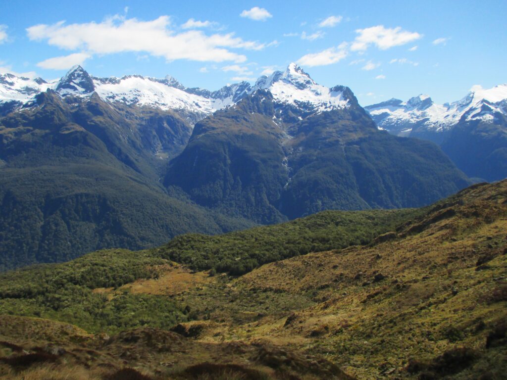
For those who are thinking of taking the same path, the walk back gives another, different appreciation of the route. I don’t usually choose to go back on myself for walks, but this gave another perspective to the walk, almost constantly looking down at the valley, from up above, rather looking up at the mountains from below. What’s more, the sun reappeared even more strongly as the trail left the peaks, revealing bright blue skies and unobstructed views.
Routeburn Flats from above
The end
I felt comfortable coming down. It was slightly rougher on the knees and back, rather than the muscles, but there was a relief from gravity becoming a friend rather than a foe on the descent. I realised, after the hike finished, I had drunk nowhere near enough the recommended amount of water. That combined with an increased body temperature for an extended period – which I wasn’t used to, led to what I assume was heat stroke and dehydration. It took me about 36 hours to recover. I haven’t made that mistake with water again. And I have becoming more accustomed to longer hikes, carrying a large pack for half a day or more, rather than the shorter bursts of exercise I had been used to previously
The way up is more taxing than the way back down. If planned ahead, you could save yourself taking overnight gear, extra food and clothing. Which will help with the hike up. You do miss out on the views to Lake Mackenzie. But I still felt spoilt with the scenery a top of Harris Saddle. If travelling light, it would be possible to travel on to Lake Mackenzie, then return. But if the time is available, I think a sleep in one of the overnight cabins, in the mountains you’re traipsing through, would be a suitable reward for the effort.
With a bit more thought beforehand though, I wouldn’t have needed the extra weight in the backpack, given there was no overnight stay. So, a bit of extra planning would have helped in that sense.
Above all, however, I remember the day for the experience of the hike itself – and how it inspired many hikes since.