Return distance: 10 miles (16km). Total elevation gain: 1,150 metres.
Caution, the mountain ascent is tricky and potentially dangerous.
I want to see mountains
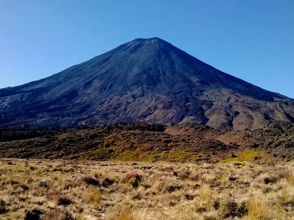
Yes, Mount Ngauruhoe was used as Mount Doom in the Lord of the Rings film trilogy, but it’s definitely worth hiking even if you’re not a fan of the films. It’s not quite as intimidating in real life as in the films, alas, it is spectacular, nonetheless.
It is still an active volcano, and it has similar grades of slopes all around, making it appear as a perfectly formed volcano – almost picture-perfect volcano. Hence why it was used in the film.
The peak is one of three in Tongariro. It can be included as part of longer hikes around the park, or it can be done as a return hike with Ngauruhoe as the objective. We did the latter, which was challenging enough, and required most of the day to complete.
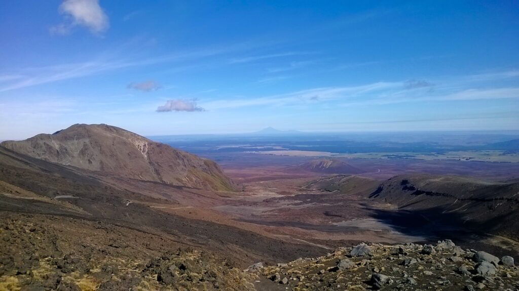
The view from the trail
Setting off
There are several points to start the hike. We began at Mangatepopo Car Park, where the mountain is already clearly visible, and grows more imposing with every step. The first 90 minutes of walking was on a relatively stony path. Then, steady inclines are introduced, with a few zig-zags to higher ground. The terrain varies, too, and part of the track is a wooden boardwalk over marshy areas.
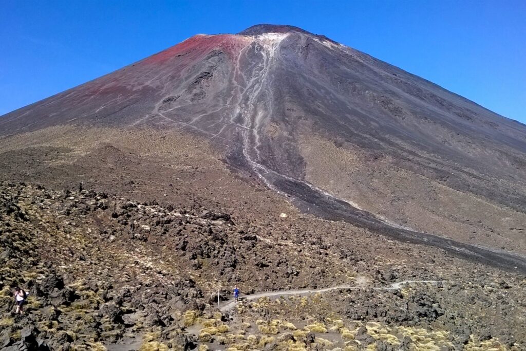
I had a good level of fitness, and I enjoyed the hike to the foot of the mountain, roughly 3.5 miles (6km) from the start. We stopped at the bottom for food, on one of the many large rocks that dotted the now stony landscape, and gathered energy for the ascent ahead.
At the foot of the mountain
The difficult ascent
I hadn’t researched the hike beforehand, so I was blissfully unaware of how challenging the next section would be. I had climbed a volcano before, I thought to myself, so I would be able to do this one without any issues. I was wrong. The route is tough, and one could easily get injured on the way up or down. In fact, we were lucky to avoid injury ourselves.
The trail up the mountainside was barely defined. Instead, we had to navigate a way up, through the loose rocks that sprawled on the steep slope. It didn’t feel very safe from the outset, and on more than one occasion I almost lost my footing, or scraped my ankles against the stones.
Cautious climbing
Steep and rocky
A near miss
The biggest scare came when, after stepping over a rock, I inadvertently sent it tumbling behind me. I had to shout a warning to those behind me, who barely had time to look up. Fortunately, the rock missed them, but only narrowly.
I did this hike in 2014, so it’s possible the trail has improved since, but a quick look on AllTrails suggests experience is required to tackle it. Be prepared for a difficult hike, for it is physically challenging ascending the slopes. It took over 90 minutes to get to the top, in a relatively short distance, but with much elevation.
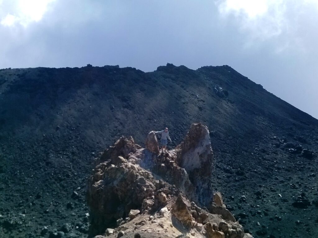
The summit trail
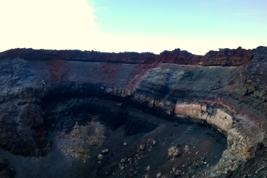
Over the crator
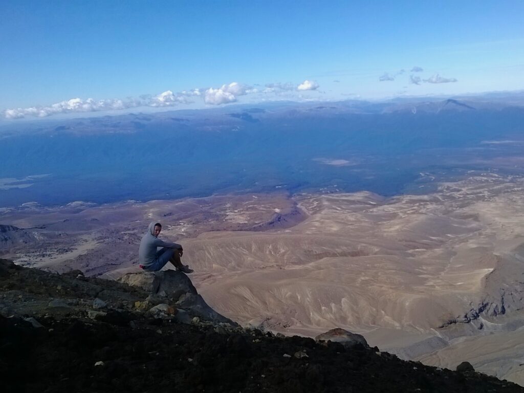
At the summit
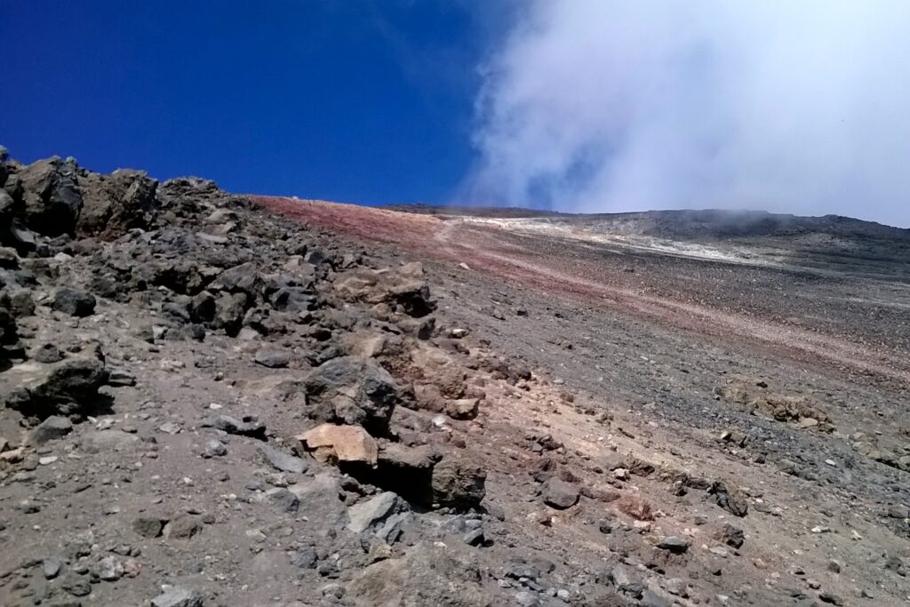
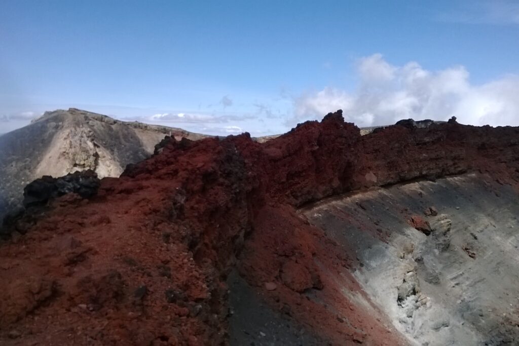
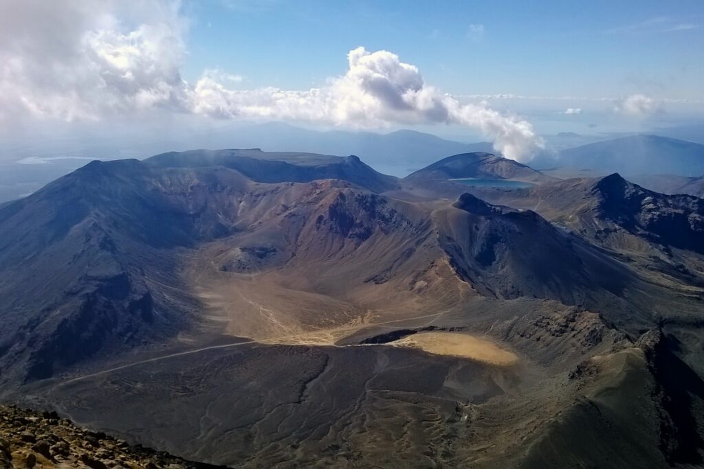
Once at the top, all that exertion immediately felt worth it. With a strong sense of relief, I could look down at the slopes – literally and figuratively – I had just conquered. We followed the circular trail at the summit, which offered panoramic views over Tongariro National Park, in every direction. Including over Tongariro Crossing – another great trail.
At the centre of Ngauruhoe’s peak is the crater. It lay menacingly below us, with smoke rising from it. There are many jagged rock formations here, to wander past and over. It is a special place, and because of the difficulty in climbing it, it is also very quiet being almost devoid of people and animals. There was a slightly mist in the air, creating an enchanting atmosphere, perfectly suited to the location.
Climbing over a rocky ledge
A quick descent
We worked up a sweat on the way up, but with the wind now unabated, and a shroud partially blocking the sun, we cooled down very quickly. We stayed at the top for around 45 minutes, enjoying the views, resting our legs, and appreciating the sun as it re-emerged.
The way down was as initially as slow going as the ascent, fearing a misplaced boot would lead to a potentially catastrophic tumble. After slow progress, we noticed further ahead a pair of hikers had developed an innovative technique to descend – almost surfing through the rocks. Through patches of small rocks, we turn out feet to the side to keep our balance, and slid down through them – the only way to name it would be rock surfing. As long as we kept our toes slightly elevated, so not to get them stuck under a rock, we would glide down with little difficulty (I wouldn’t recommend this on most hikes, though!).
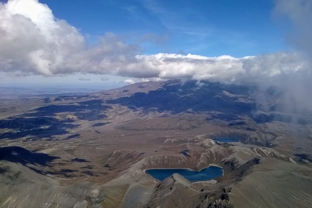
Tongariro Crossing
Panoramic views
And back again
I don’t think I have ever done anything quite like this on a hike since. This unorthodox style sped up our return down the mountainside by as much as four times – reaching the bottom in around 20 minutes from the top. We only had a few cuts and bruises to show for it.
Once back at the foot of the mountain, we could leisurely walk back on the gently descending path back. Although it was the easiest part of the hike, the day’s effort had taken its toll, and I was glad to reach the finish.
The route back
A rewarding challenge
At approximately 10 miles (16km), this hike requires good fitness to complete. And the climb up and down the mountain requires dexterity and balance, as well as a great deal of care.
If you decide to take on this hike, and complete it, you will be thoroughly rewarded with views of and around Mount Ngauruhoe, as well as Tongariro National Park. It is a vast volcanic landscape of rocky, barren terrain, with large lakes and, of course, many peaks and ridges. It is one of the North Island’s most impressive natural wonders.