Ben Nevis is the highest peak in the UK (most of the other tallest mountains are in Scotland, too). It also very popular and attracts a lot of daily visitors, meaning it can be very busy. The climb is very challenging, physically – I strongly believe it is worth it, though.
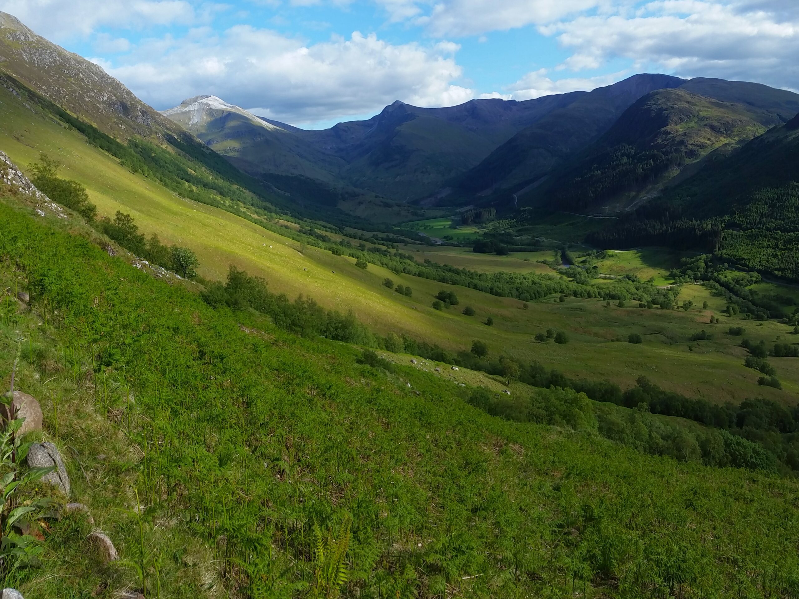
The hike delivered great vantage points. I went up on a day with a mixture of clear skies and modest clouds, so I was treated to views far and wide. Ben Nevis sits above its namesake, Glen Nevis, a peaceful valley, as well as countless Munros on all sides, and sea lochs beyond – to the west.
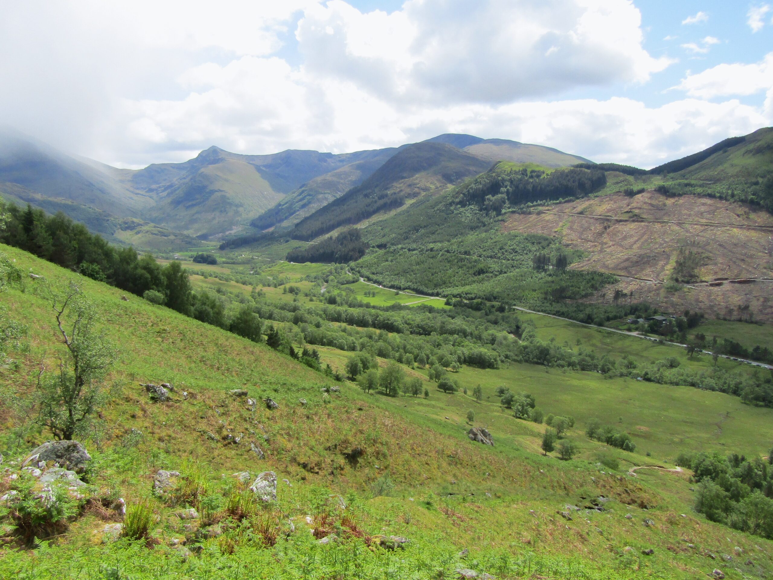
Glen Nevis
Late start
I started the hike later in the day, around 2pm, after driving from the Isle of Skye as part of a Scottish Road Trip. This gave me the unintended convenience of missing the crowds that start the hike throughout the morning. I avoided many potential traffic jams that can stifle and frustrate quicker hikers here.
A popular starting point for day hikers is in a car park that sits east of the nearby town, Fort William. The trail crosses farmland that stretches below two mountain ranges – into the lush green valley of Glen Nevis. This is the gentlest part of the ascent, so enjoy it.
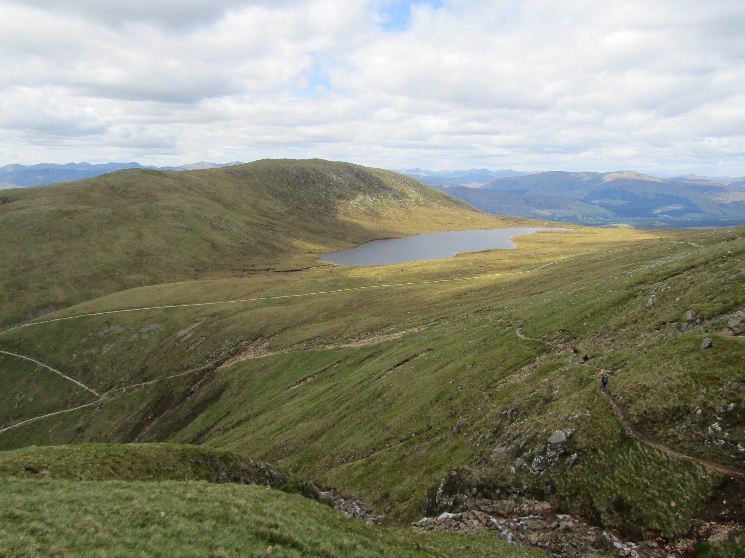
Known as Halfway Loch
The path up
The trail continued mostly straight for nearly two miles, at a decent but manageable incline. It then turned in towards higher ground. There is an intersection, as there are two paths that divulge slightly, although they meet up shortly after.
The path begins to zig-zag up the slopes, a mixture of dusty trails and stone steps, that are physically demanding. This is where my body was tested, as I found the steps particularly gruelling. I understand that a path is more likely to erode under a barrage of footsteps, and a constructed path is more likely to withstand the demands of hundreds of hikers. But the hard surface does result in greater strain on the muscles and joints.
The reverse view
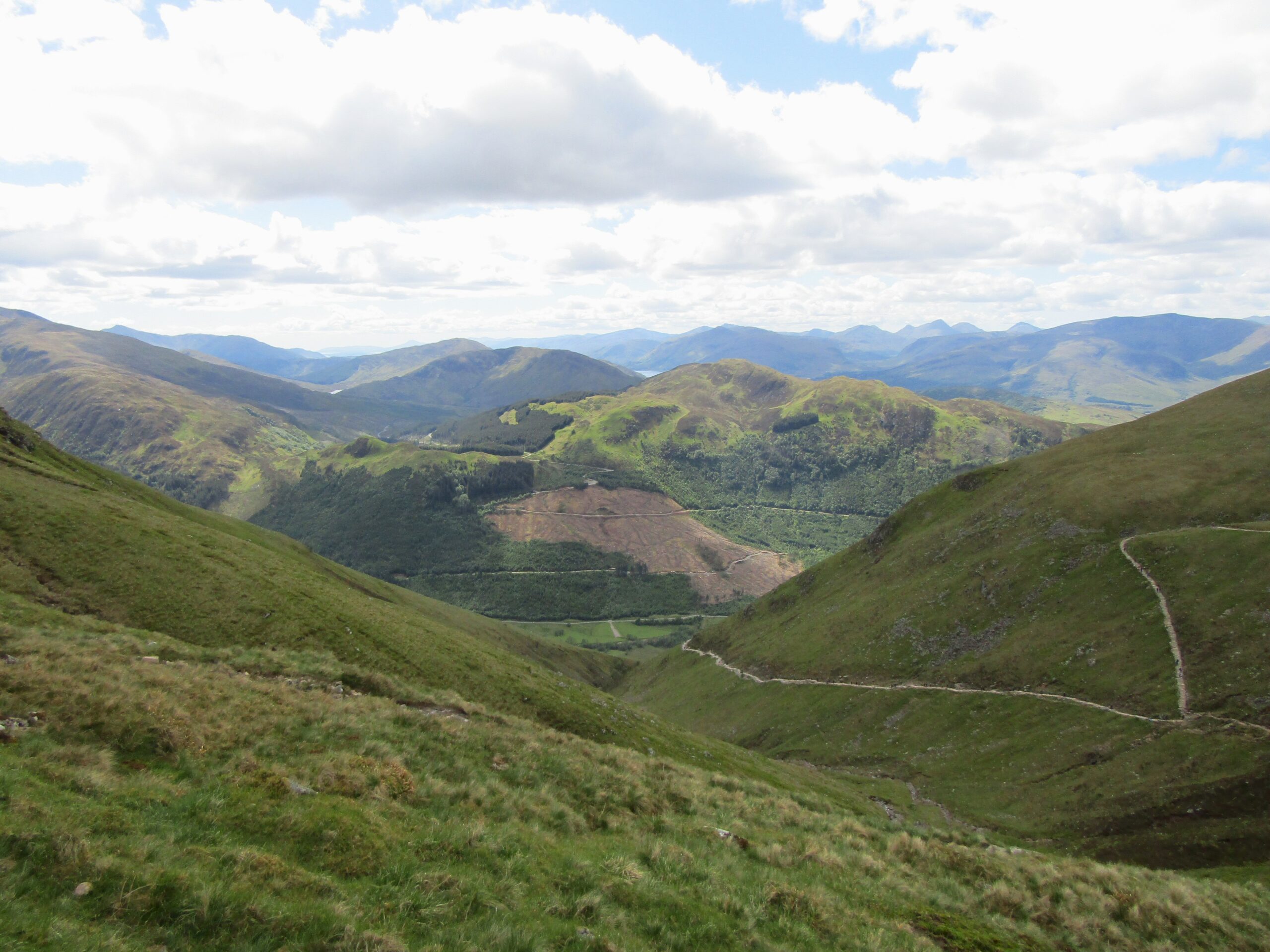
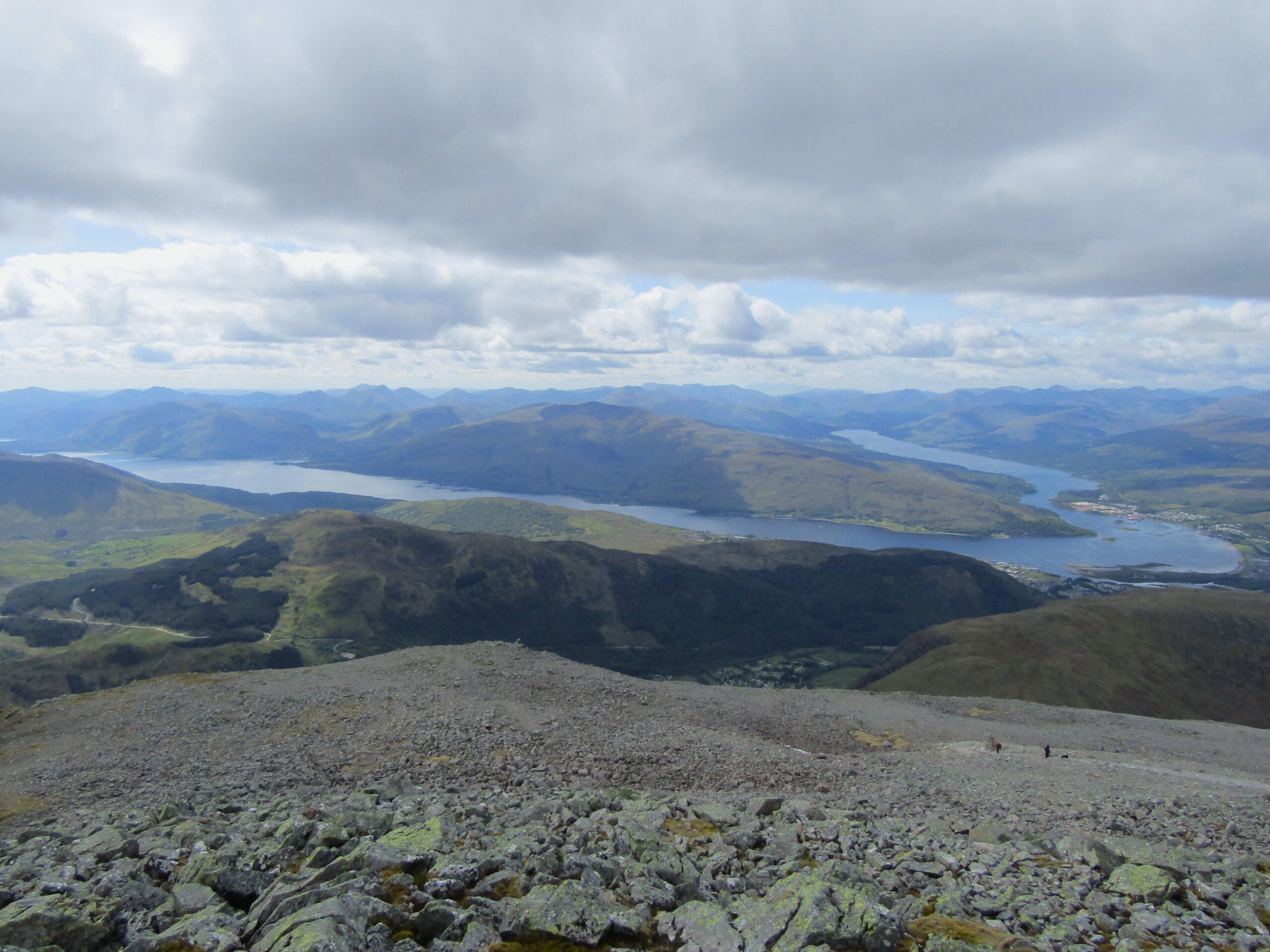
The best view
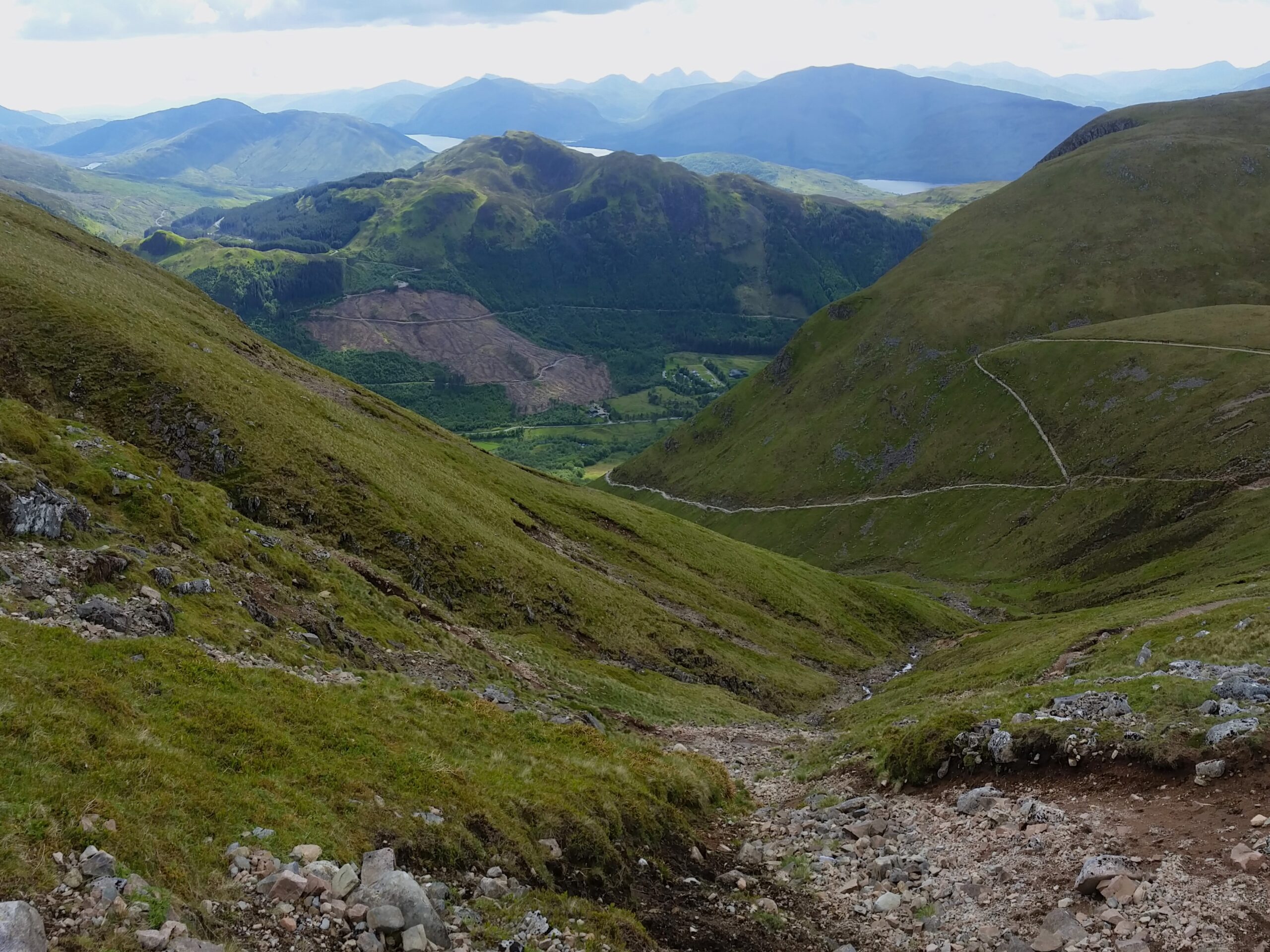
I found the best view about halfway up, looking back toward Glen Nevis. Two dark slopes on either side, framed the lush green valley below, with the deep blue of the sea lochs beyond. This is some of Scotland’s most dramatic scenery.
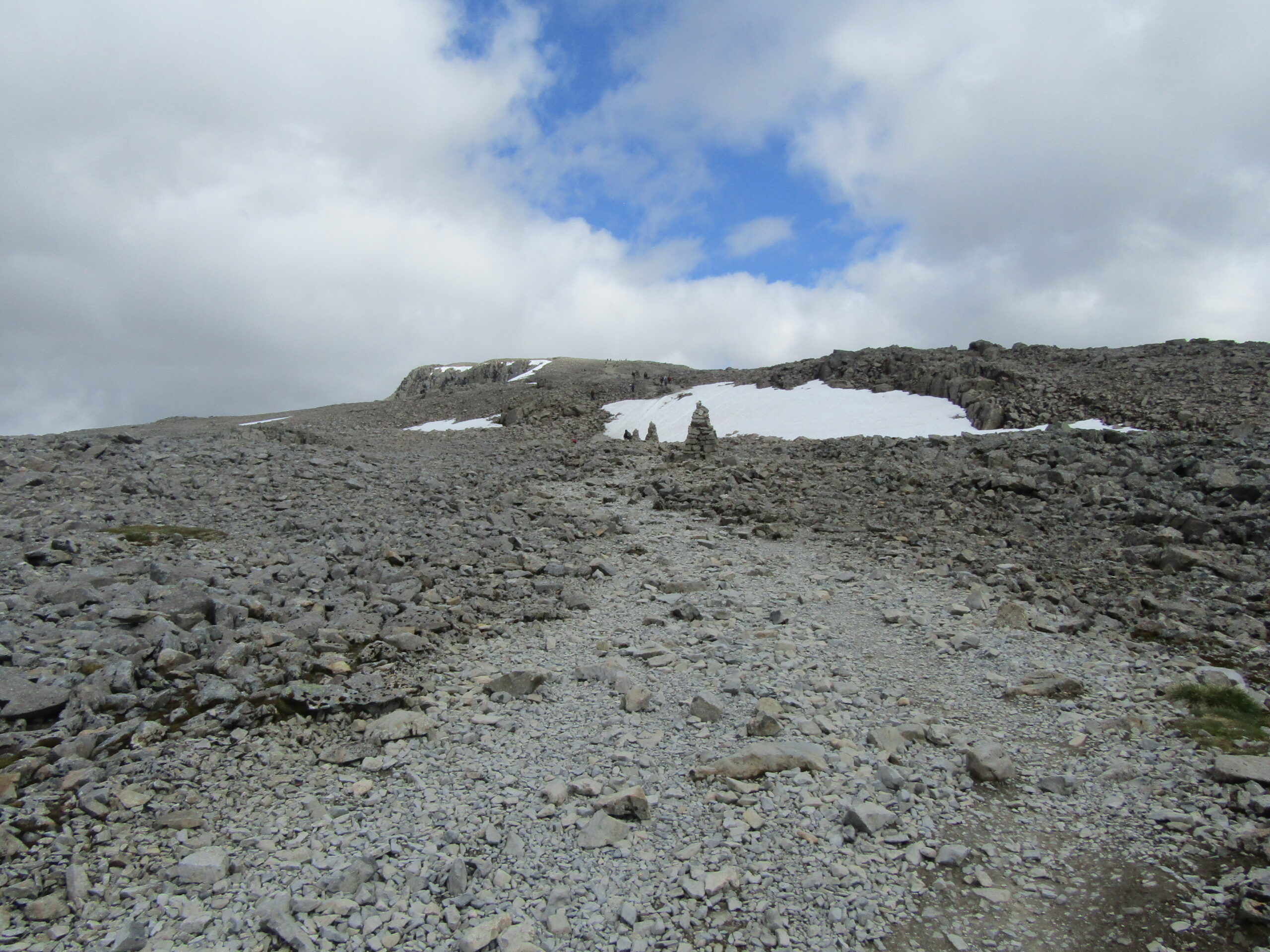
On the latter half of the ascent, the terrain next to the trail transforms into a grey, largely barren, bed of rocks. I was starting to feel the strain, but I pushed on in effort to make it to the top before the temperature dropped – knowing I could stop for the views on the way down. It was around four and a half miles to the summit (7km). The last two miles were tough inclines.
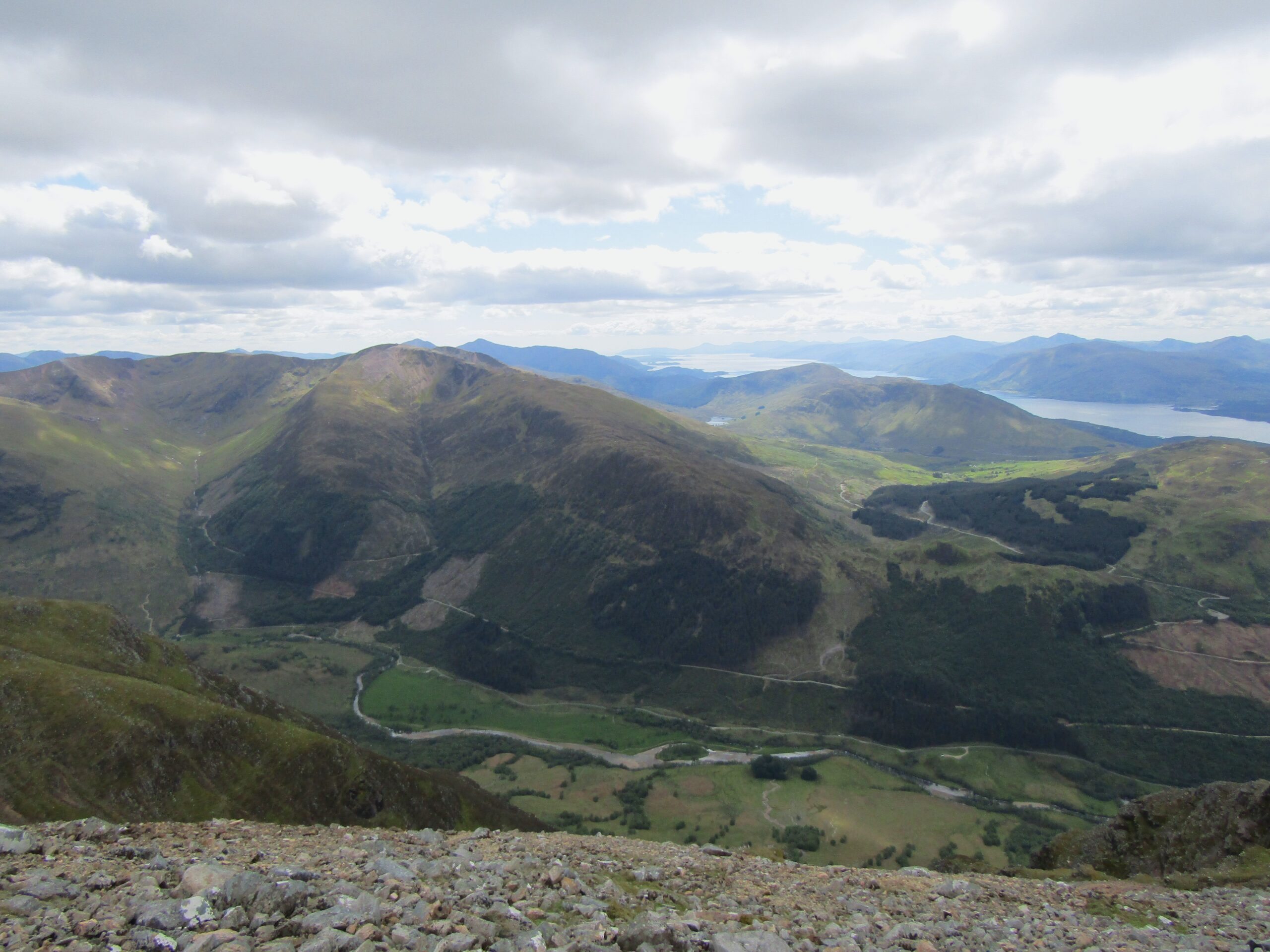
Over Glen Nevis, The Munros, and out to sea
The sea loch
Summit
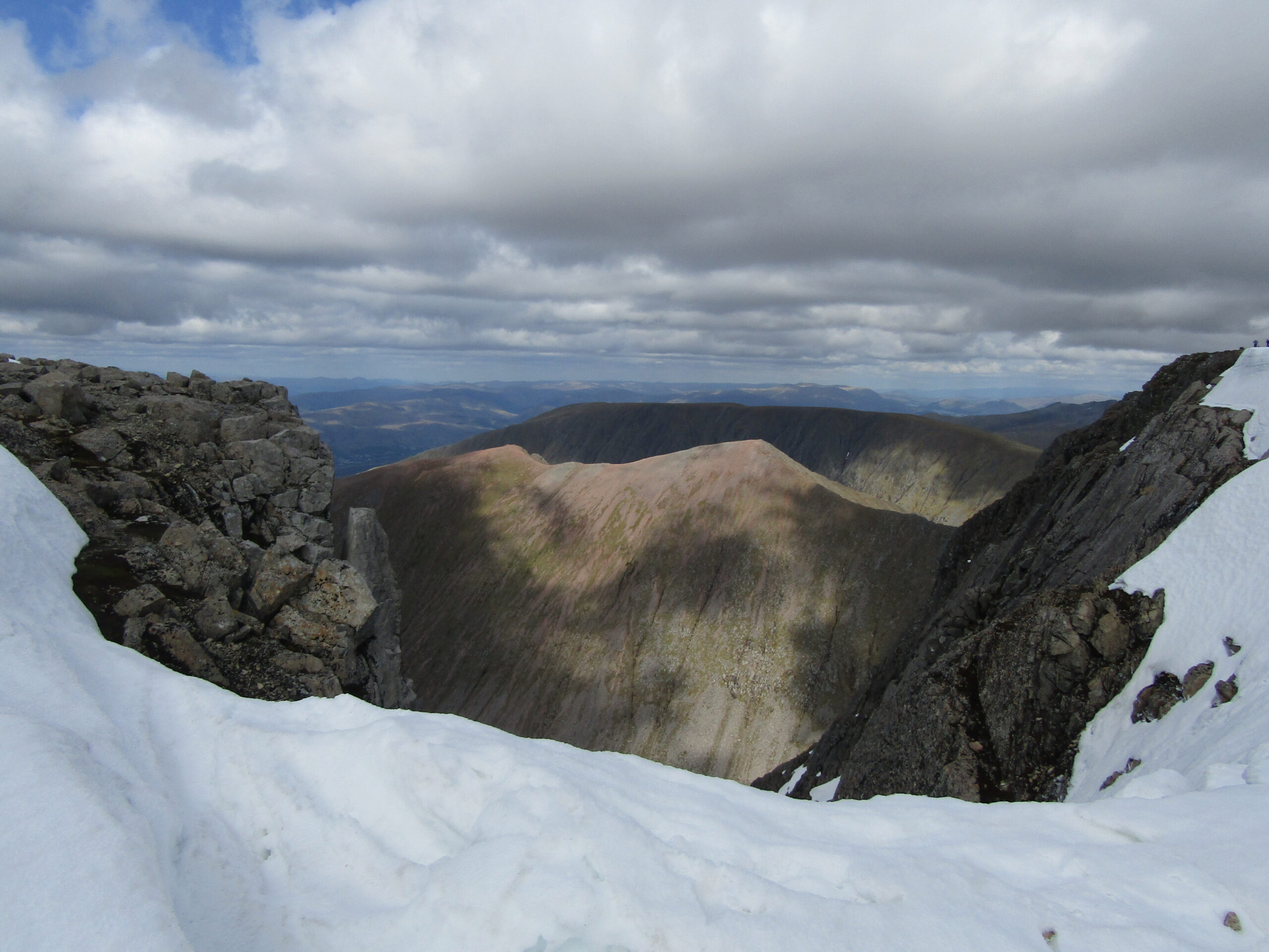
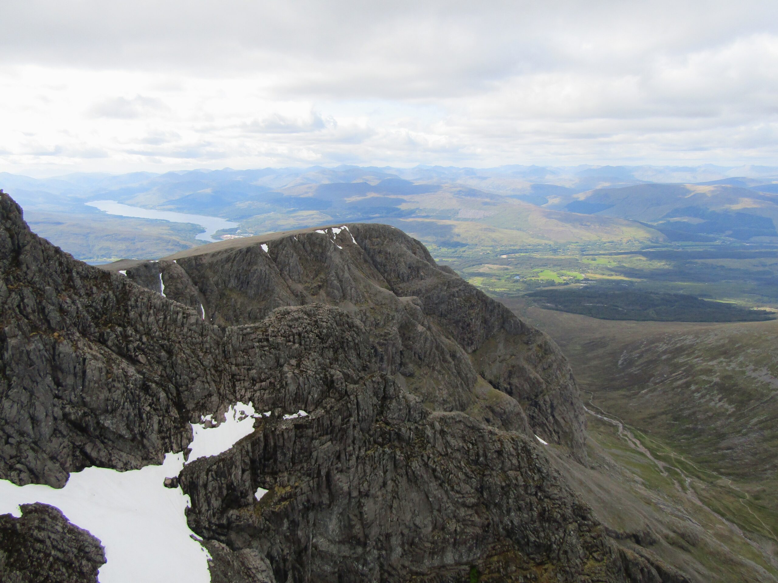
The summit provides views on the other side of the mountain that are as spectacular as the rest. It felt as if I was on top of the world, looking down on the other Munros nearby – large, too, but still lay below the giant I stood on. At one point, by a jagged outcrop, there is a vertical drop into a deep valley – which I believe is a possible climbing route.
As always, the effort to hike up made me sweat profusely. Once at the top, the wind blew wildly, and the air was noticeably chillier. Even in mid-May, there was snow on the ground. I went from being a hot, sweaty mess to a shivering wreck, and cold to the bones. My hands quickly went numb, so, after a short tour around the summit, I decided to head back, out of the wind.
The steep climb
Snow on the summit
A view down
Fatigue
I realised I’d pushed myself hard on the ascent, as I felt tiredness setting in. The stone steps were harsh on the joints, especially my knees. And going down still requires a lot of focus. The temptation to bound down must be curtailed, for the risk of one misstep and it’d be a painful roll down a jagged edge.
In the knowledge I had done the hard part, I could relax a bit more. I would stop and take in the views at will. Then, around halfway down, I had an unexpected, wonderful encounter (cheesy moment coming up). My girlfriend decided to hike up partway – and we met at the point of my favourite view over Glen Nevis. The mixture of fatigue and surprise nearly overwhelmed me. I smiled all the way back.
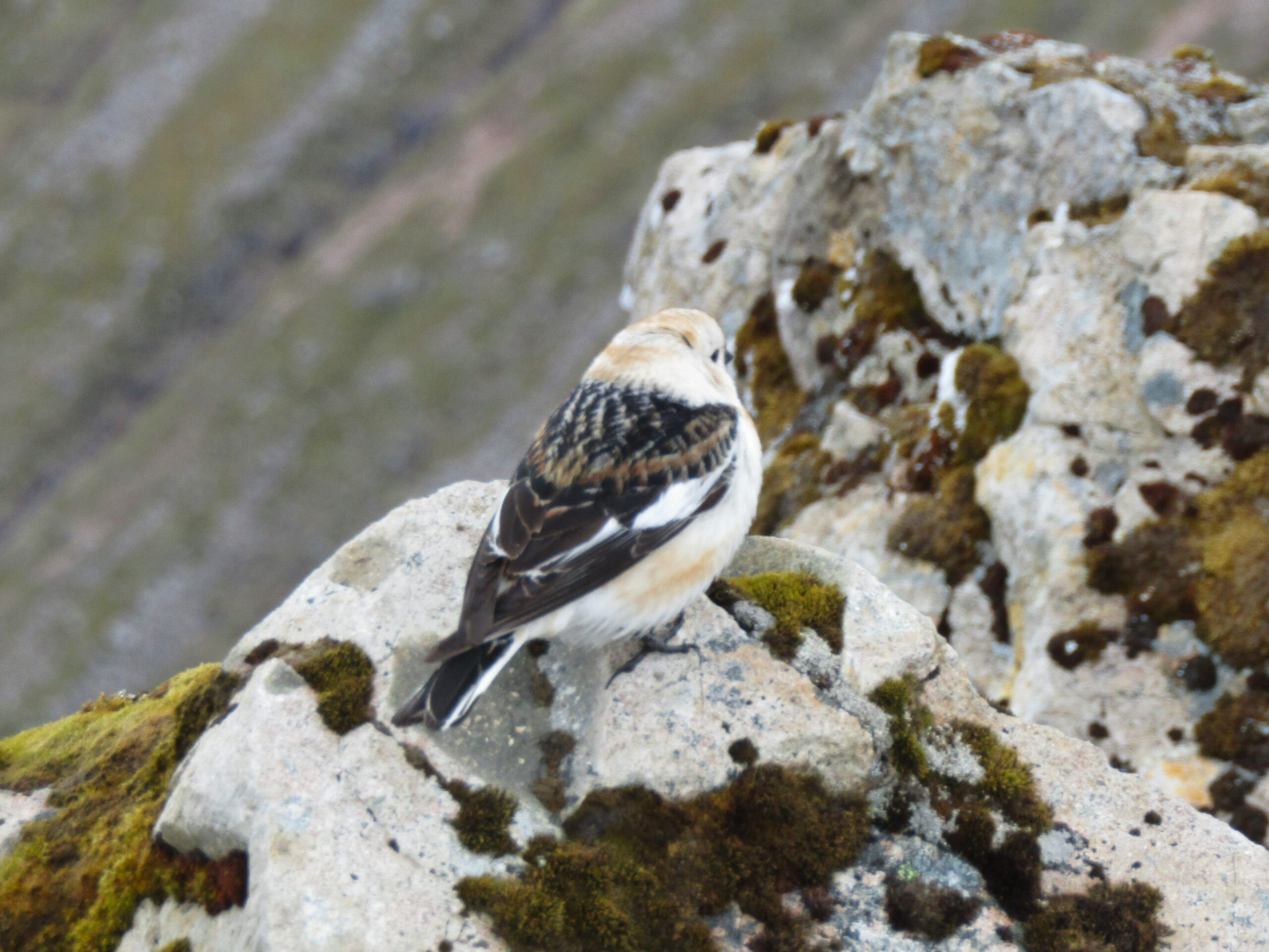
A bird braving the cold
Completion
We walked back at a gentle pace, and as we came back down to the farmland, I took a final look toward the valley and up to Ben Nevis – grateful for the opportunity, while relieved it was over. I had hiked just short of ten miles (16km) with a total walking time slightly over four and a half hours.
I was in good shape when I tackled Ben Nevis in 2019, and I say that to manage expectations for others – this hike is difficult and could push you to your limits. There are plenty of opportunities to stop for breaks, water, and food – so make use of them. There is no shame in turning around, if it’s too much.
My favourite view
Looking back
I was lucky with timing, in the sense of avoiding groups on the way up, and perfect hiking weather. In different conditions, the hike may be less rewarding or enjoyable. No one wants to be in a queue. And there are countless stories of rescue missions on Ben Nevis, most often because of poor conditions.
Walking in a group is fun, and others can provide additional encouragement when the going is rough. I don’t begrudge the popularity of the hike. Beware of the potential challenges, though, and plan it for maximum enjoyment. I would recommend it for the outstanding scenery, plus the achievement of triumphing over the UK’s tallest peak.