In 2021, I took on the last of Britain’s ‘Three Peaks’,. I had hiked Snowdon in 2017 (1,085 metres) and Ben Nevis (1,345m) in 2019. At 978 metres, Scafell Pike is the least difficult of the three. I made the challenge more interesting by injuring myself on a run three days before, and fast or awkward movements were still causing me sharp pain. I was in two minds about whether to attempt it, but when it came to it, I couldn’t resist the opportunity.
The Three Peaks are sometimes combined as a single 24-hour event – that requires driving between each hike. I can’t think of anything much worse after a hike than sitting in a cramped car, let alone two long drives to the following hikes. The challenge is usually for charity – a noble cause – so I wouldn’t discourage the idea. I do think there are more sustainable, equally tough, and more sensible ways to do it, though.
Heading out from Seathwaite
My driver
I was fortunate that my selfless girlfriend agreed to drop me off at Seathwaite, north of Scafell Pike, to start the hike. She would then drive for over an hour, round the mountain, and wait for me at the end – Wasdale Head – west of the mountain, allowing me to see different scenery either side.
The Lake District is known for rain, and clouds gather most frequently at the peaks of mountains. There were already a few at the summit before I started. Luckily for me, the rain never came. And my sight was only obscured at the very top.
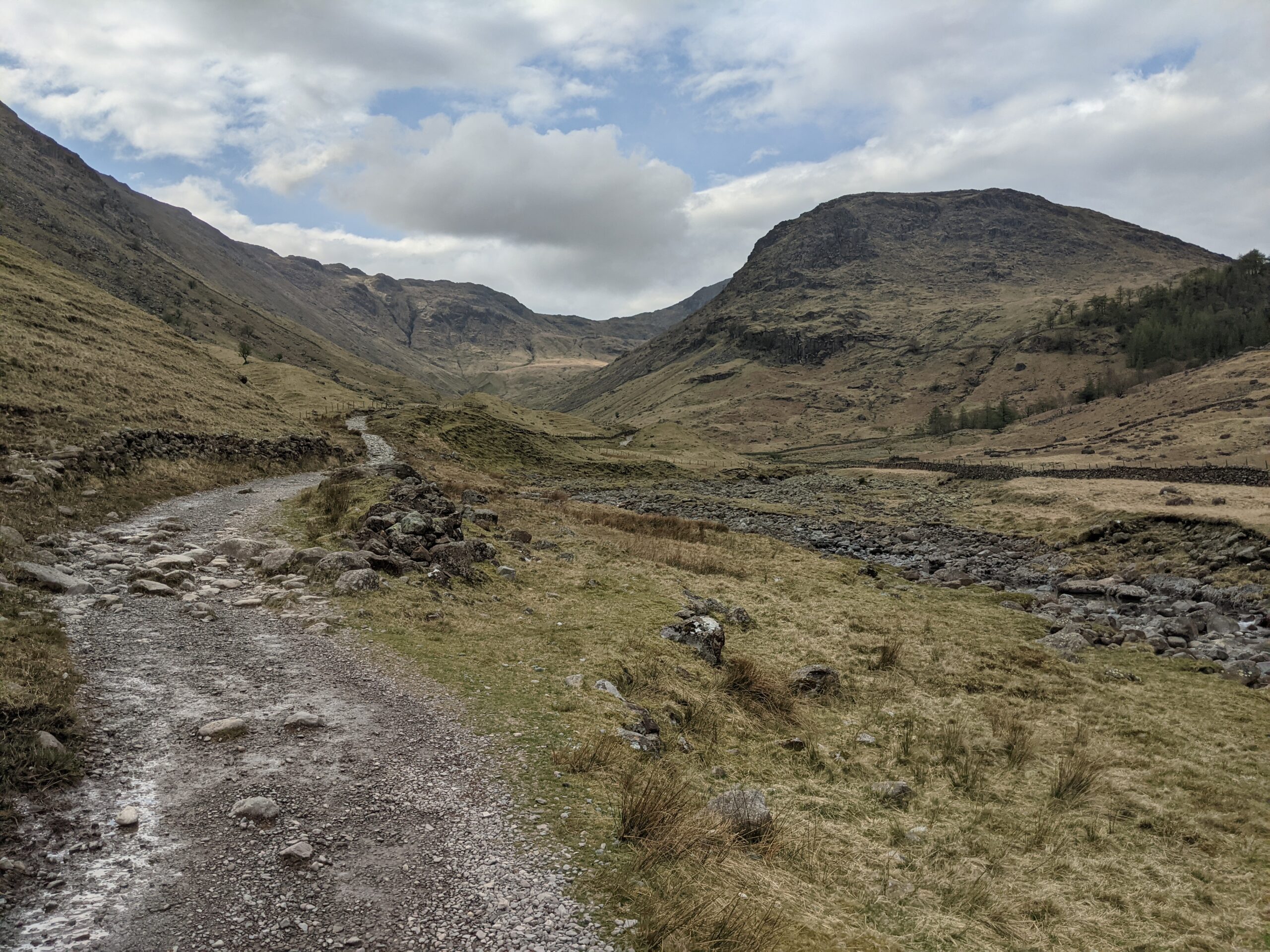
Following the stream
Setting off
A quiet drive through farmland and woods took us to Seathwaite, which consists of a few farm buildings and a campsite. It is a peaceful, unassuming place, but for the imposing mountains around it. The trail begins at the farmhouse and passes a field of livestock. Shortly after, I found myself on a rugged trail heading directly towards England’s tallest peak.
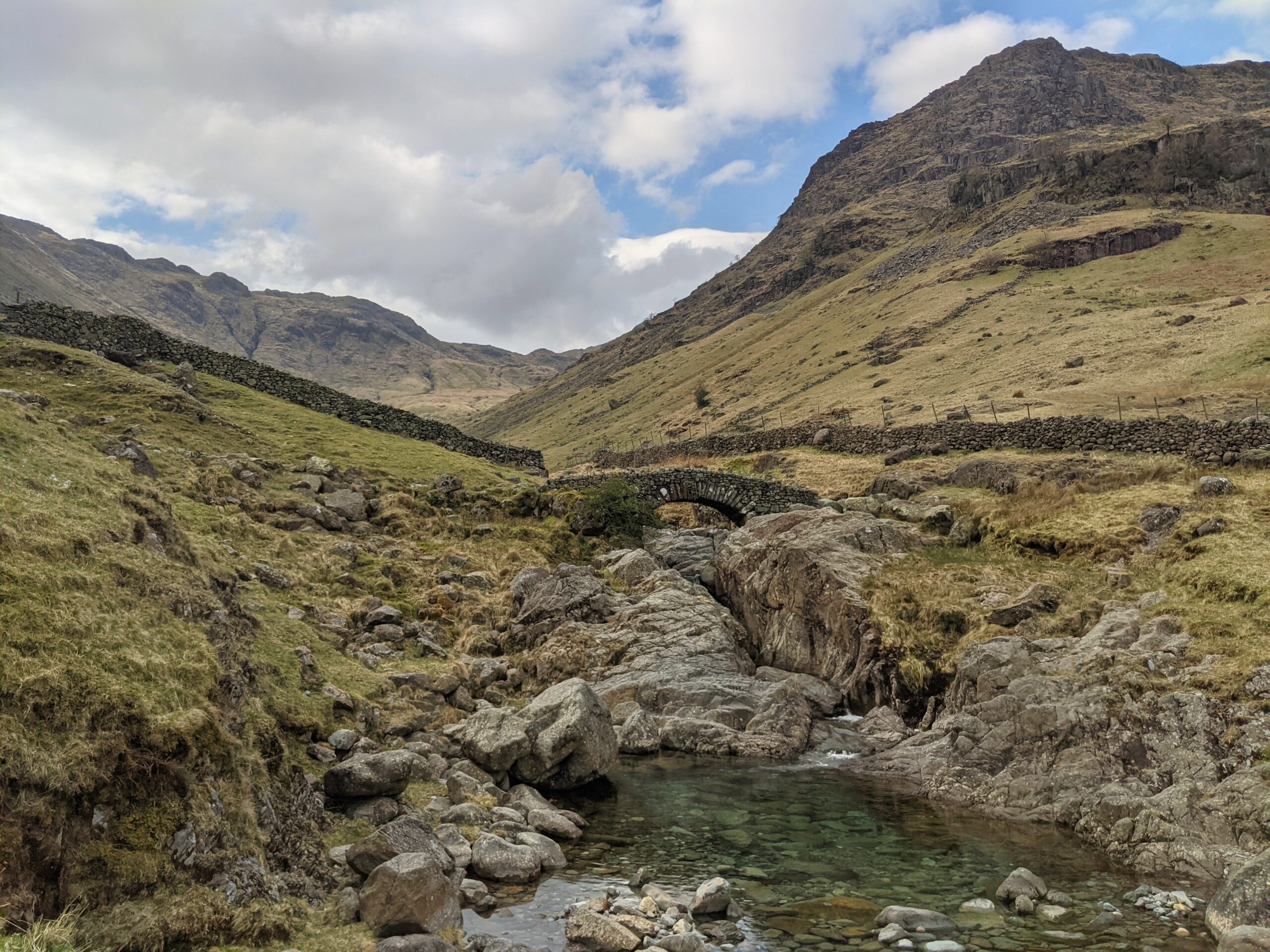
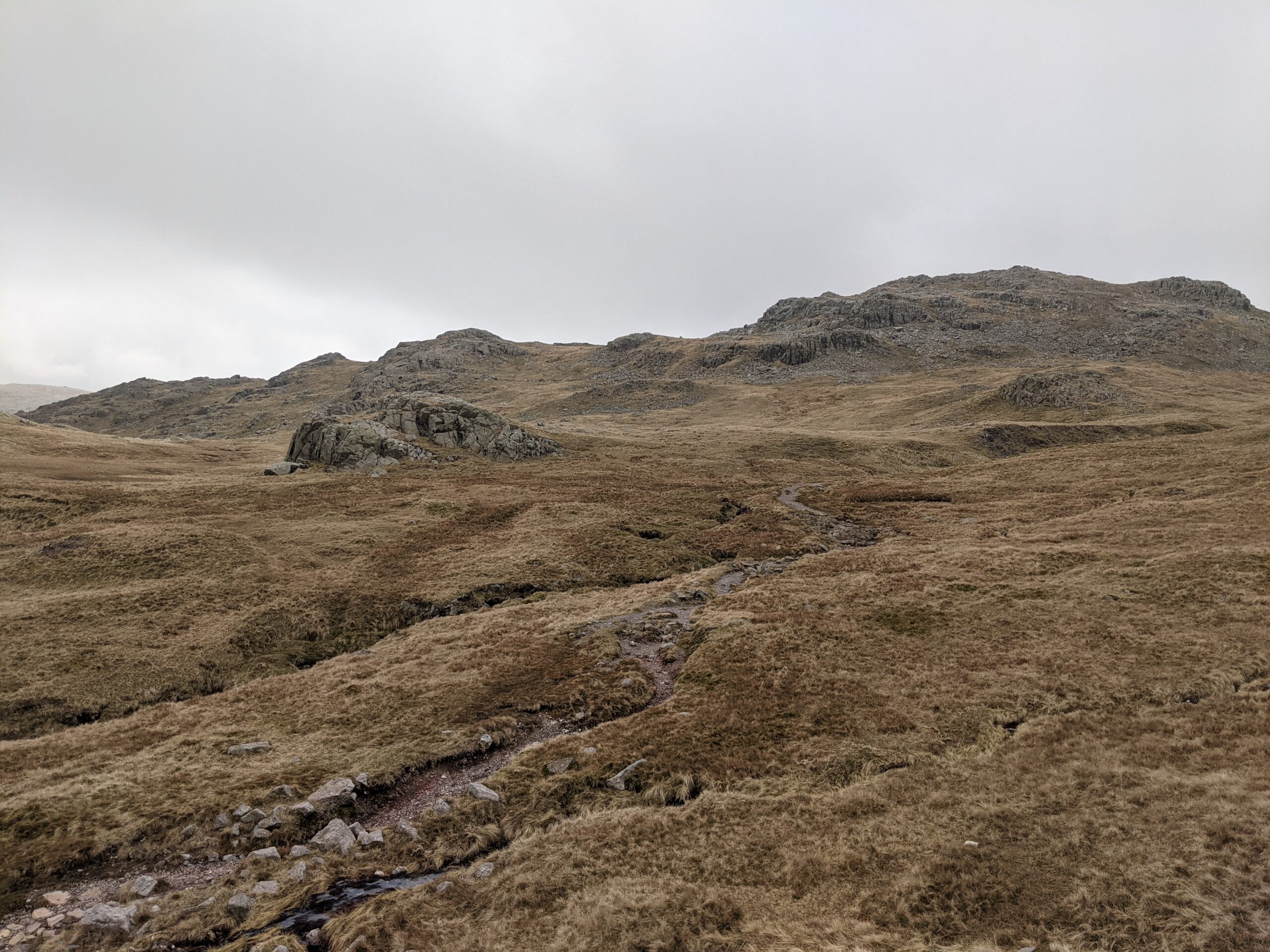
The hike started with a modest climb, and I maintained a steady walking rate for approximately a mile and a half (2km). I passed grassy slopes on both sides, as well as rocky stream adjacent to the path, running opposite to my walk. As I progressed, the valley became narrower, and the surroundings greyer and browner, as the grass was replaced by rocks and bare land.
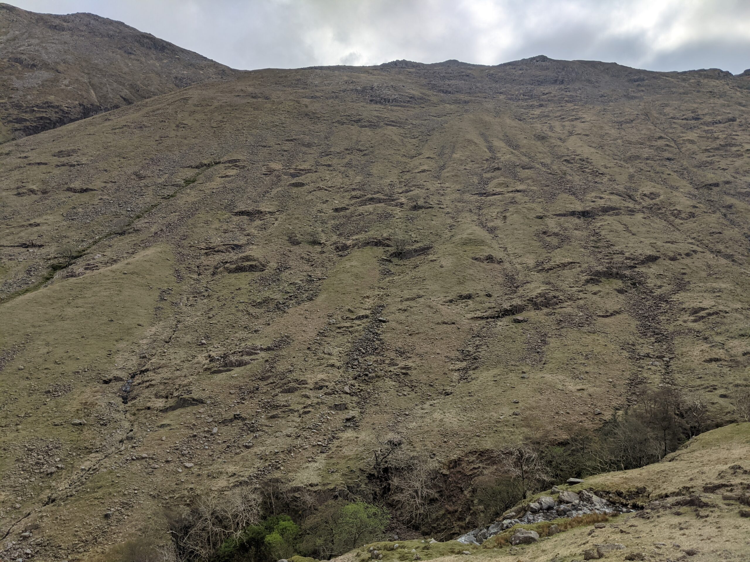
The dry slopes
Heading up
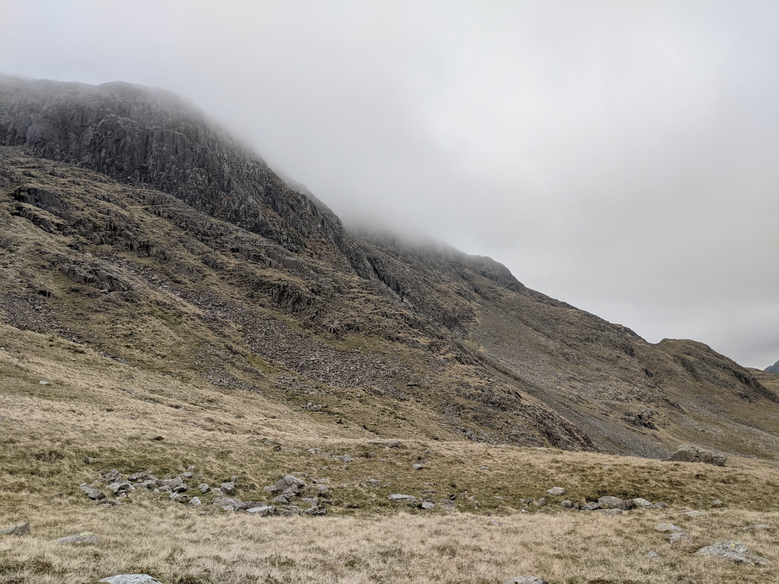
The inclined increased at this point. For the next two and a half miles (4km), I was climbing up to the peaks on steeper paths or stone steps. This was the tough section. I learnt England’s tallest peak demanded respect as much as its neighbours.
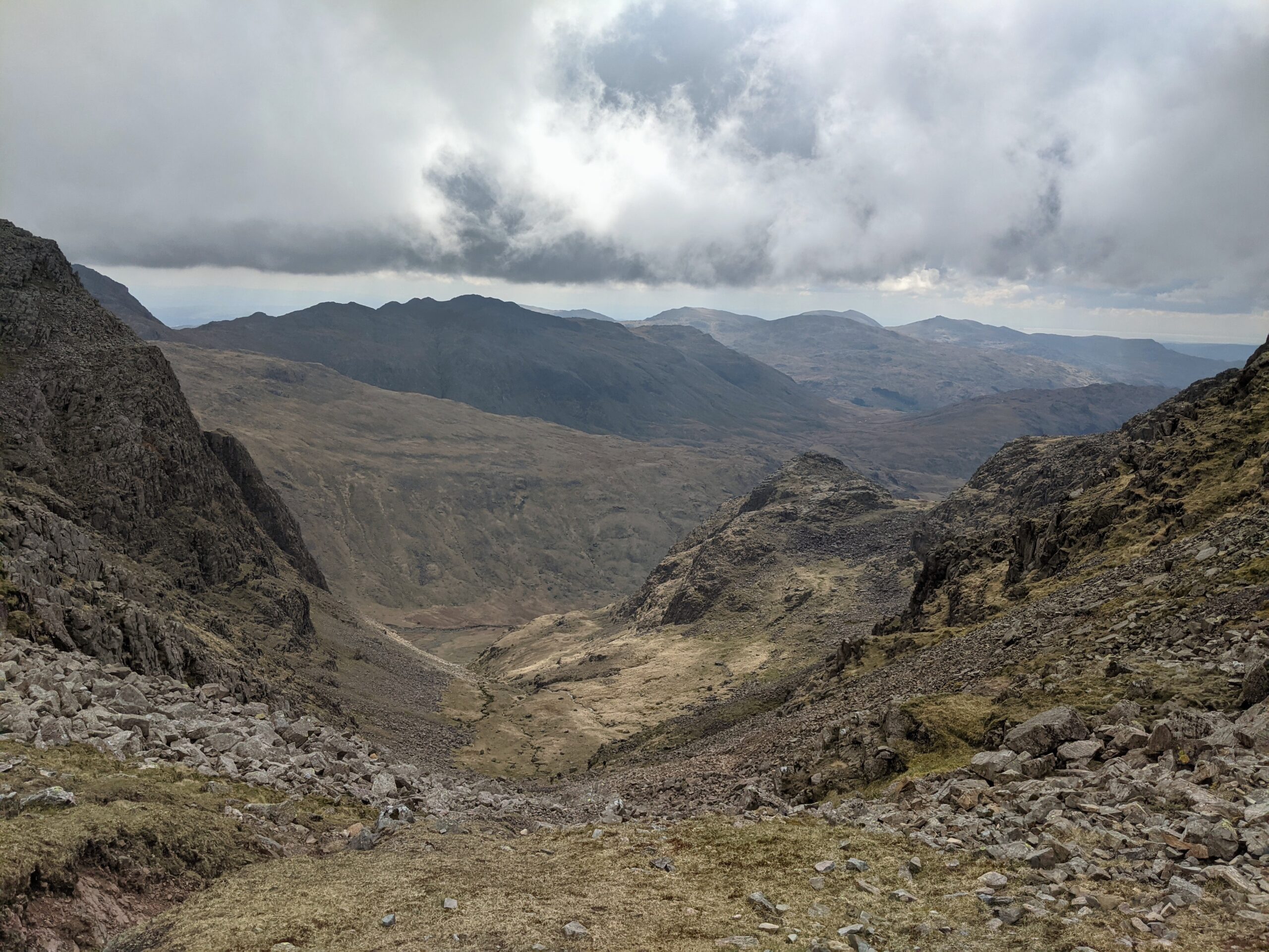
The climb also rewarded me with superb views. Ahead of me, a daunting mountain top. To either side, ledges sloping down towards me. And behind, the best view of all – looking back through the valley I had traipsed through. As I climbed, the landscape became more desolate, and the clouds were closing in.
The rear view
The shrouded summit
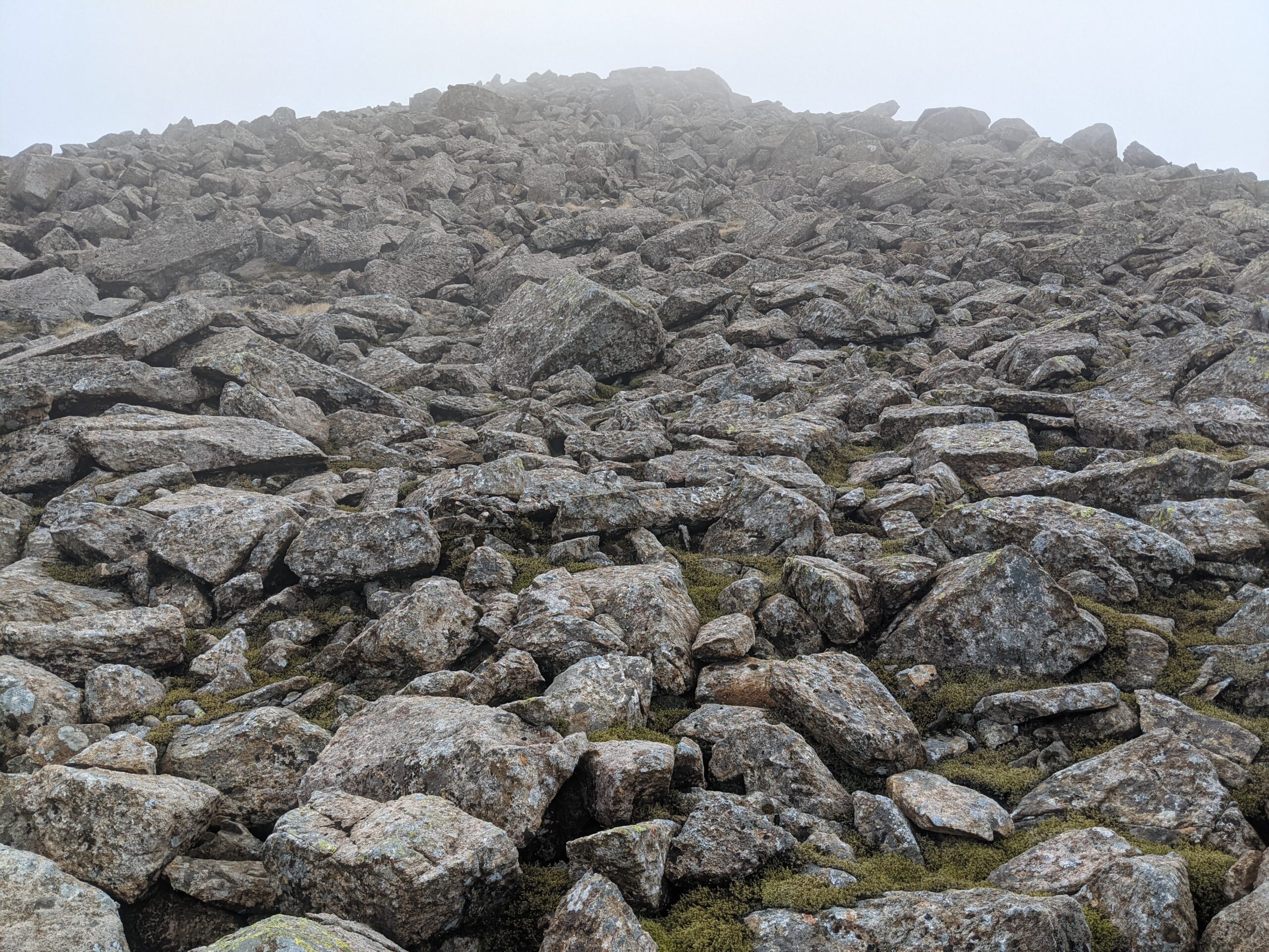
I feared losing my way as the fog drew down and decreased visibility, and I saw very few others hiking this route. I did encounter a pair who were walking their dog – the border collie was combing the hike with a game of fetch, running to the ball before returning it with such ease, while we struggled on.
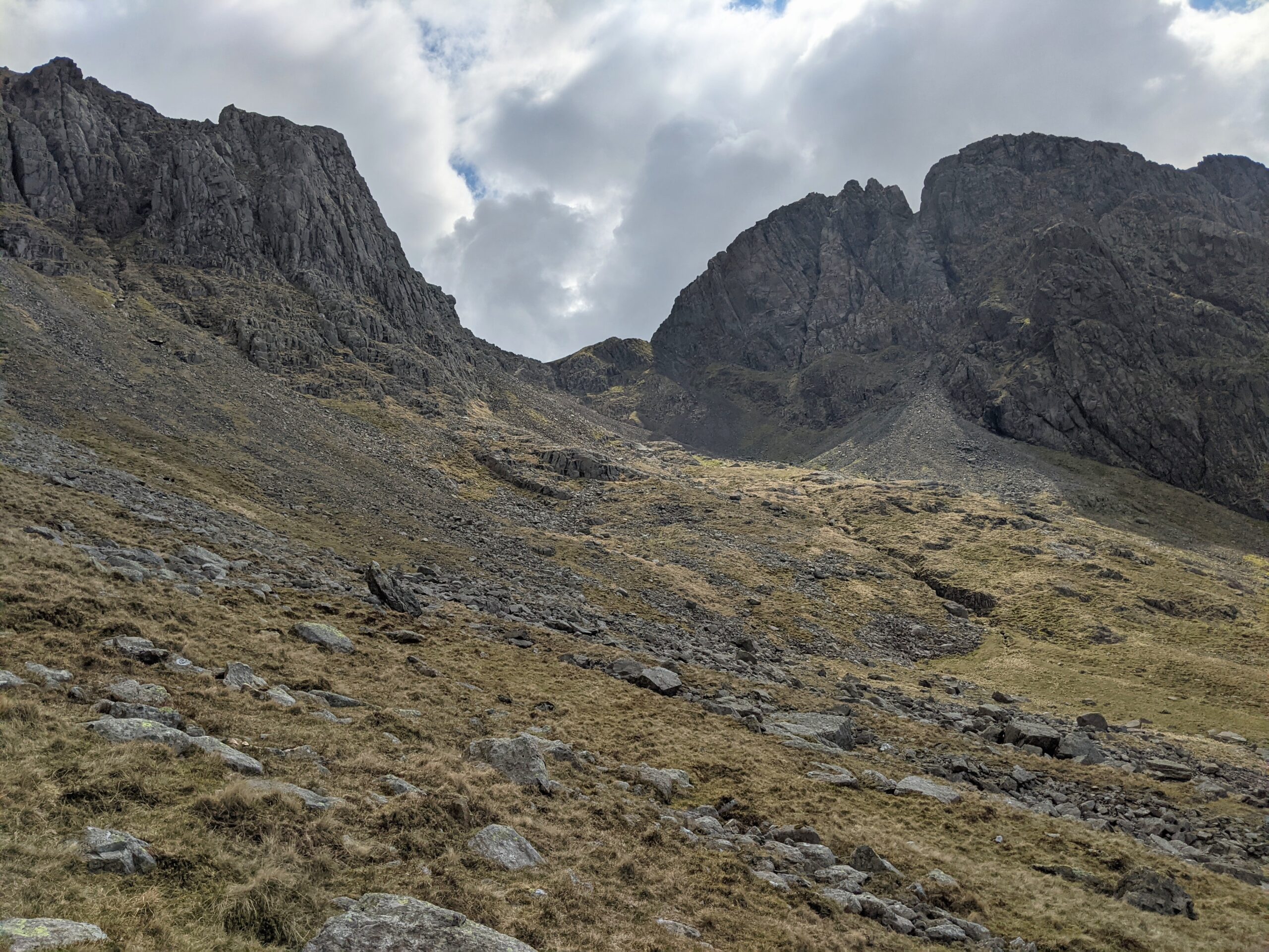
I managed to stay the course, following the rocky path to the summit. As usual, a conventional monument marked the highest point – also the windiest point so far. A few hikers huddled around the stone walls, drinking and eating. I wasn’t enjoying the cold, so I quickly headed on, to the path that would take me down the other side.
As the clouds drew nearer
The plateau before the final ascent
Rocky slopes
The trail to the top
The views
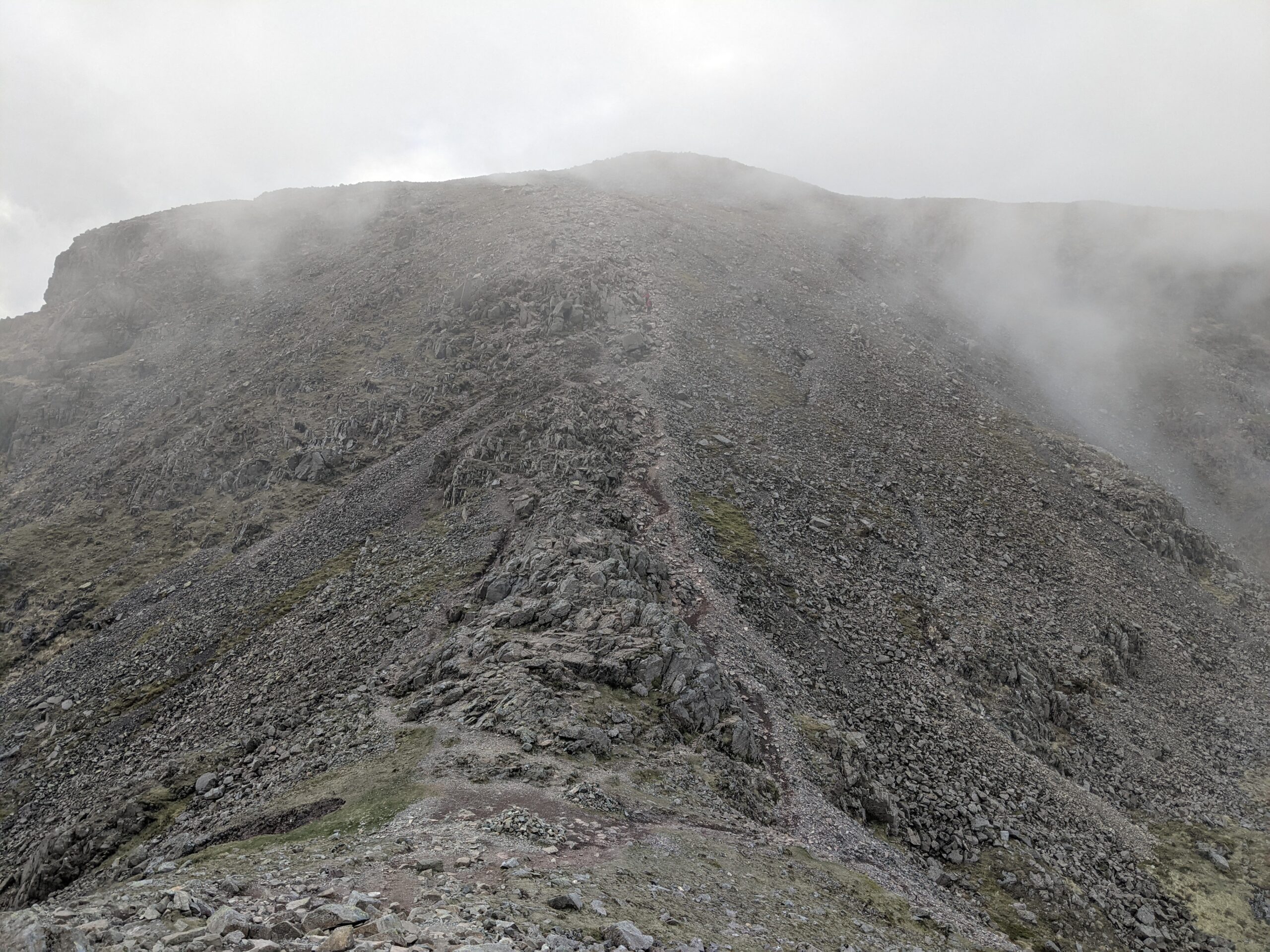
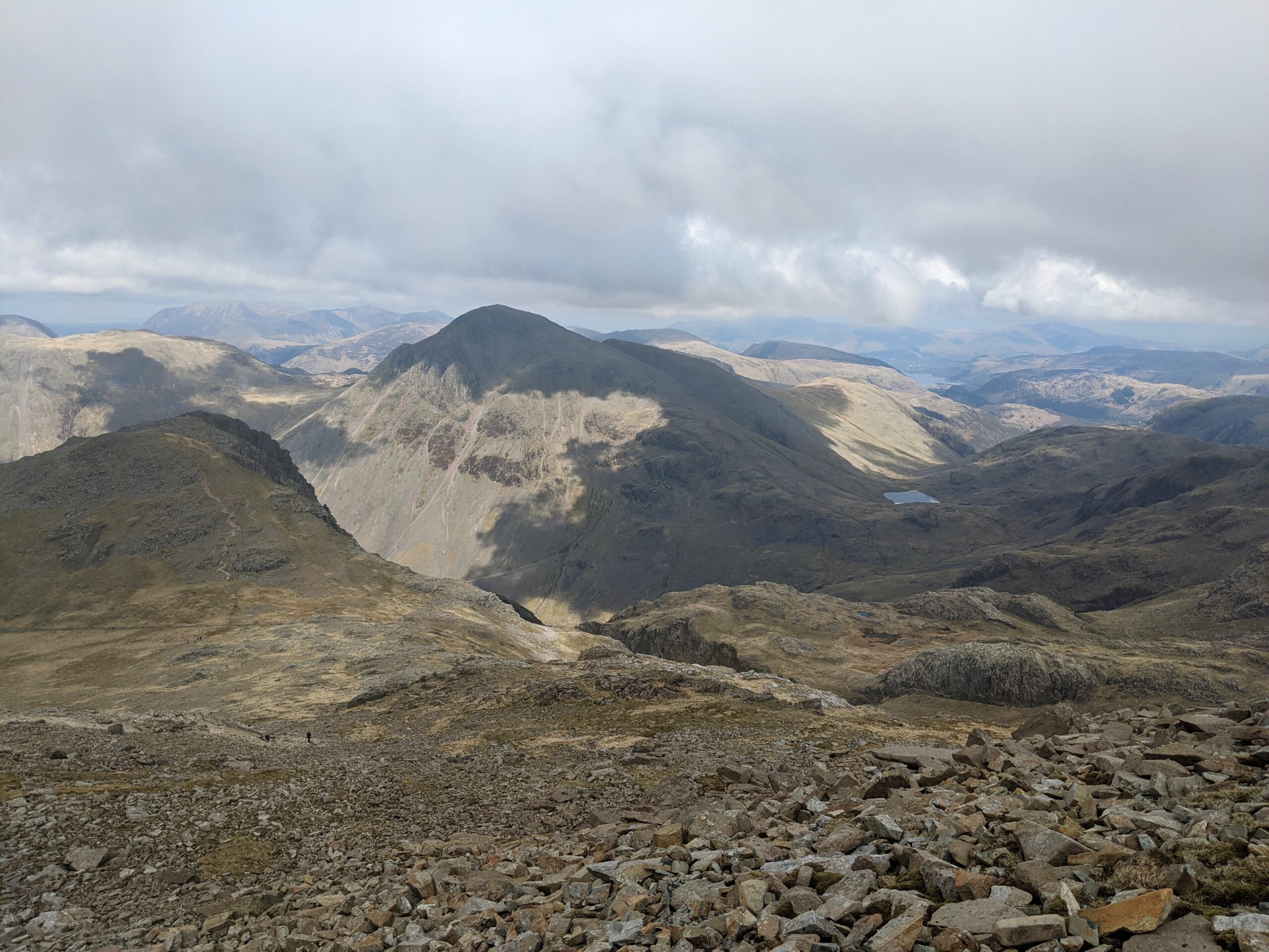
To my surprise, not far from the summit, the fog gradually dispersed. I could begin to see further and further away – with some spectacular views. This area of the Lake District, at that time of year, was distinct from other areas due to its lack of colour – seemingly lifeless. Rather than greenery, a barren mirage of grey rocks and brown soil was displayed.
Yet it is no less impressive, with steep peaks, deep valleys, and a multitude of trails to explore. The brilliantly named Great Gable stood out, due to a vertical drop on one side – a challenge for another day.
One of many valleys
Towards Great Gable
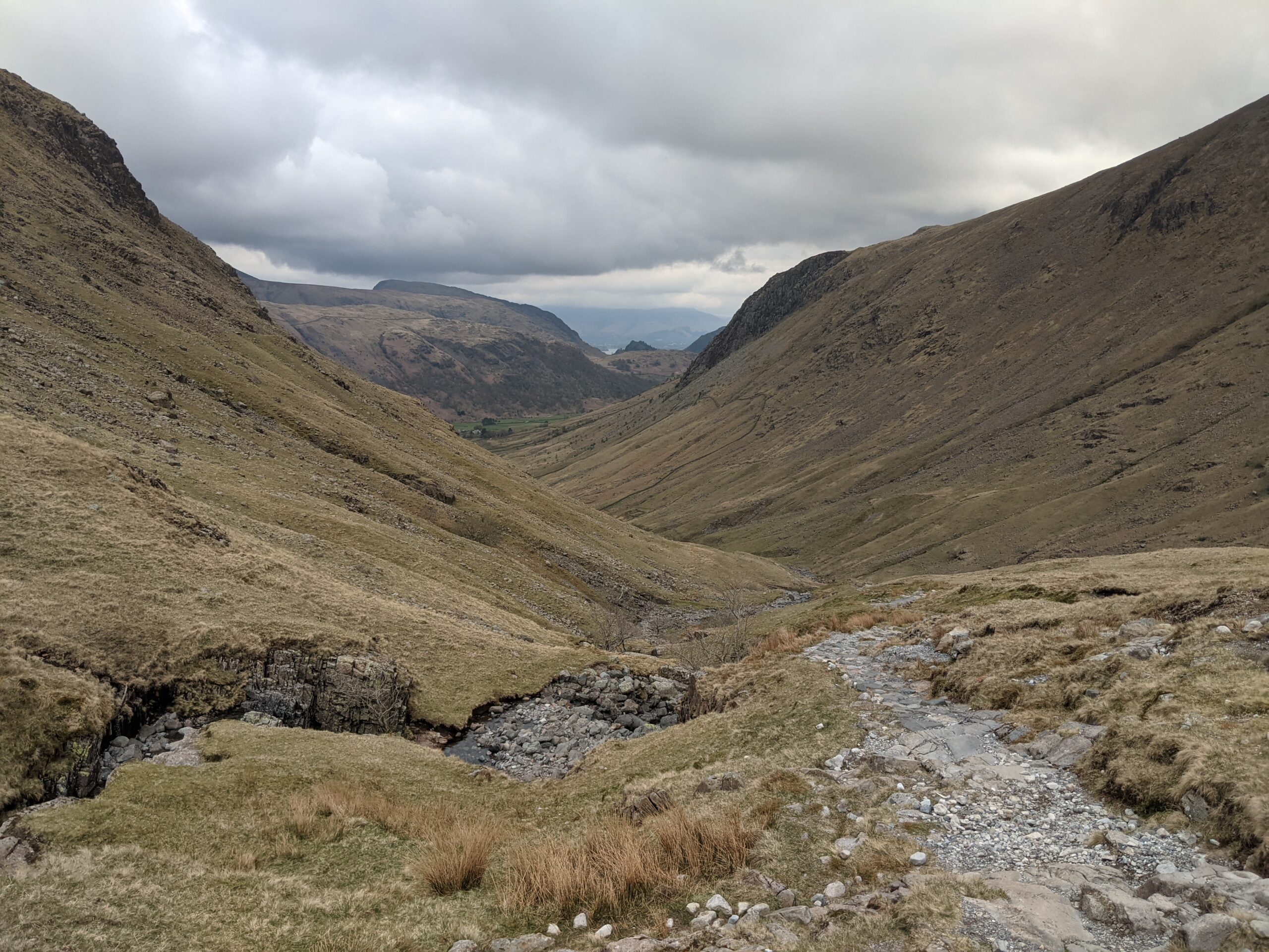
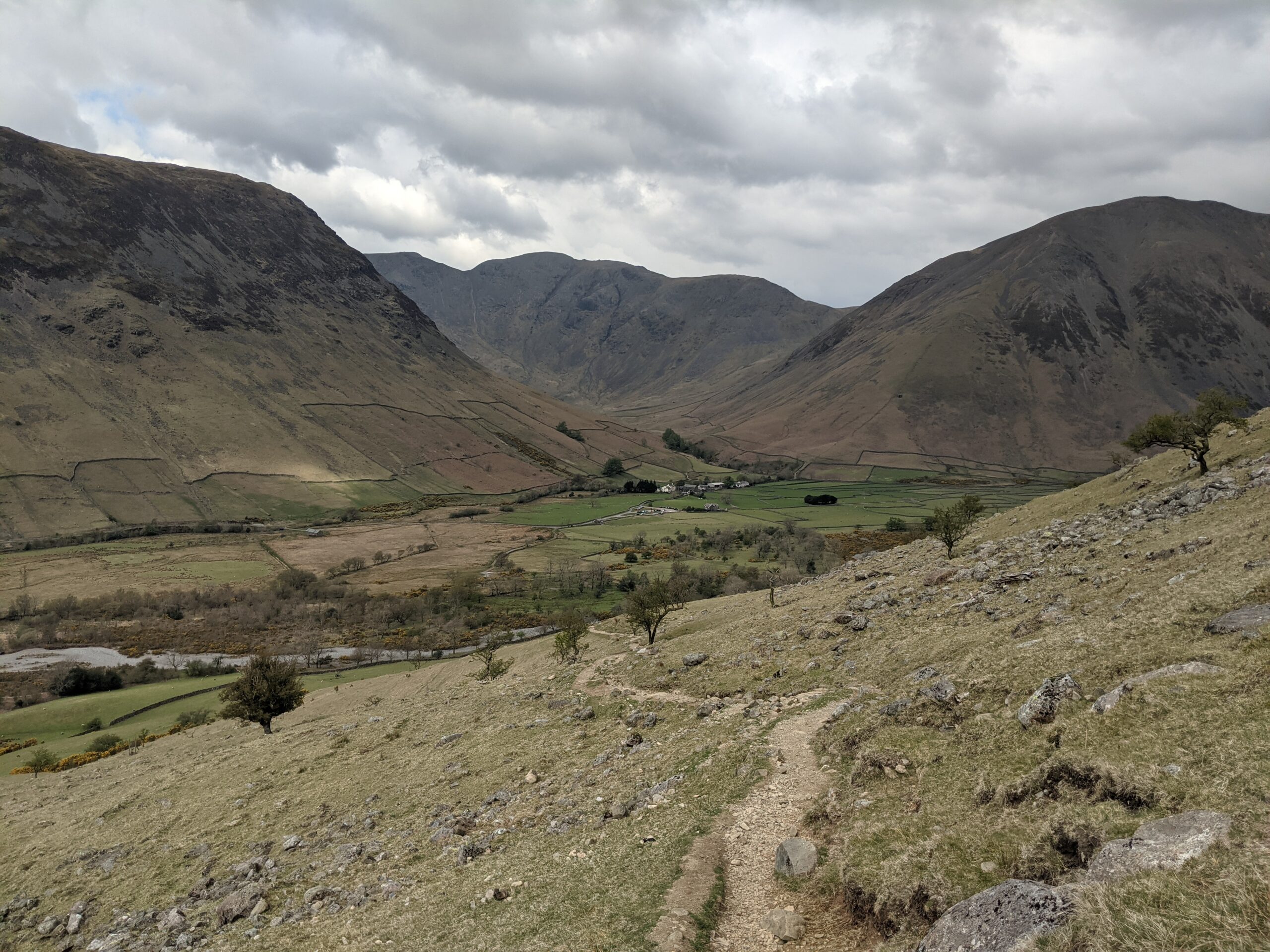
Heading down
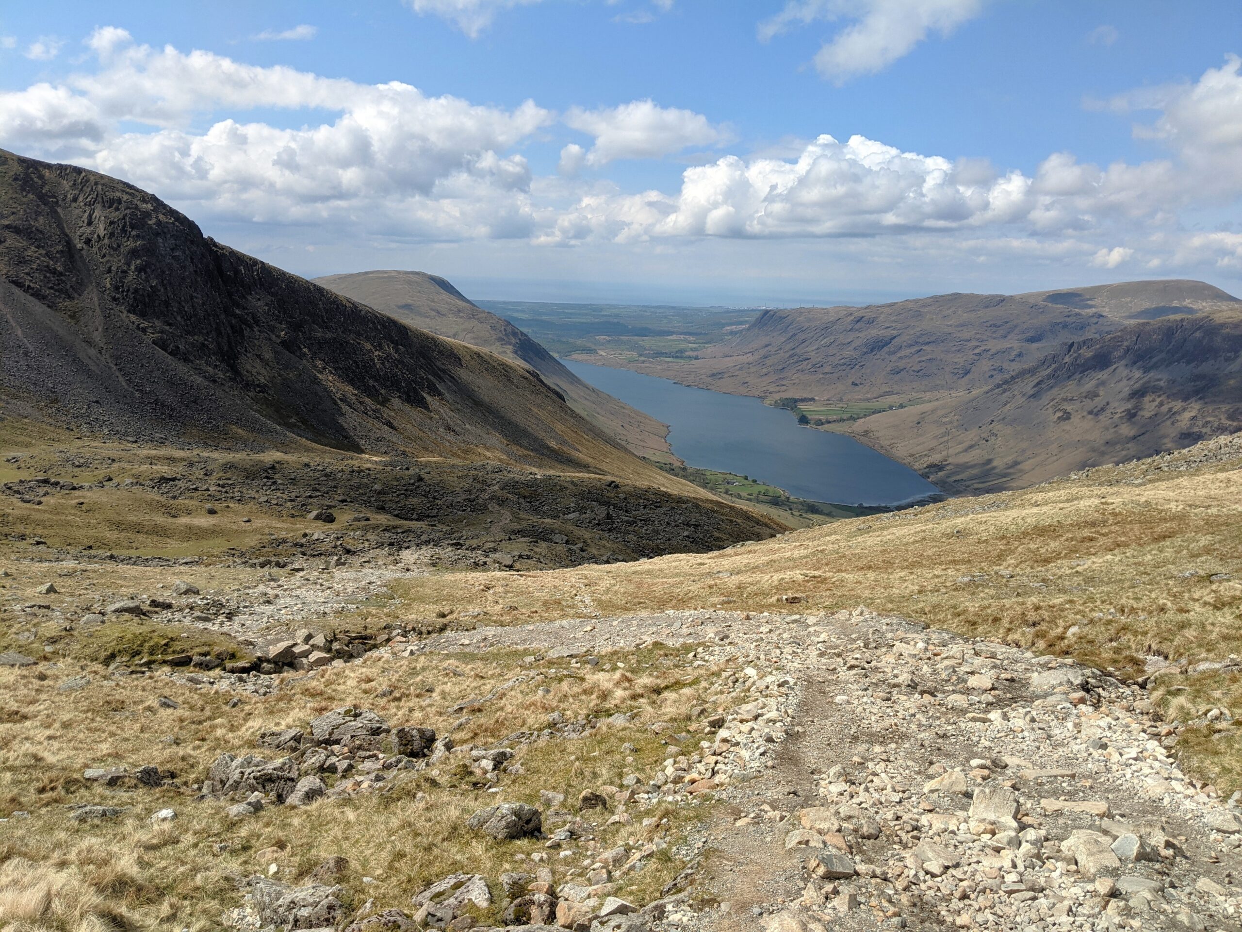
As I made for Wast Water far below, I met weary hikers that were heading up in the opposing direction to me – I sooner realised why they looked so beaten. This route up is particularly steep, and it was clearly a harsh ascent. Luckily for me, I had gravity on my side, and skipped merrily passed them.
A few people stopped and enquired how far they had to go. Naturally, those I met first were nearest to the summit, and I happily let them know they weren’t far off. With those further down I treaded more carefully, admitting they had awhile to go, but assured them it would be worth it.
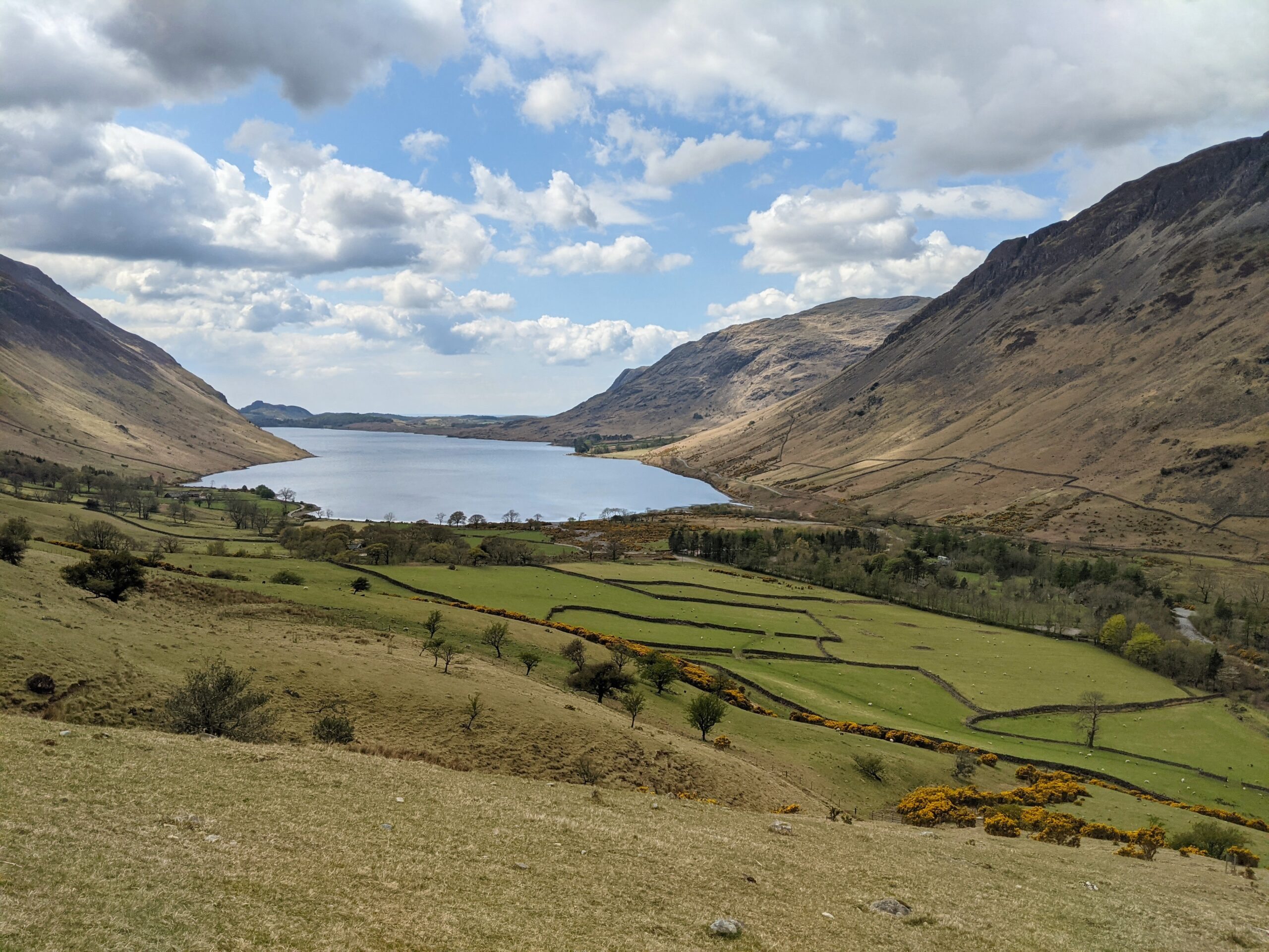
Heading to Wast Water
The scenery
It was definitely worth the effort. I love hikes like these, where there are a variety of landscapes along the way. Halfway down I could stare up at the ridge on the southern side of the mountain – a naturally-formed palisade. On the latter half of the descent, I edged closer to the large lake at the bottom.
Wast Water is encircled by gentle, rolling mountains. I had visited here a few years before on a road trip, having read it is one of the most scenic spots in the UK. Although it was less colourful in early Spring, and mostly under cloud cover, it remains a beautiful sight.
The mountain walls
The grand finale
I had completed over seven and half miles (12km) in just over three hours, including a tough ascent on the first half. I avoided aggravating my injury, yet made good time. I would thoroughly recommend the hike – while advising that it requires a good level of fitness, and to take caution regarding the weather.
As I approached the end, the sun broke through for a moment. The water on the lake sparked, next to the green fields, and under the mountains beside. This was a magnificent scene to end my hike.