When I told a friend I was going to the Lake District, he recommended I hike up to Helvellyn. He accurately described it as having great views, which I wholeheartedly agree with, having now completed it. Yet he failed to mention Striding Edge – a narrow, stony ridge near the summit – which is tricky, to say the least.
The hike as a whole is challenging because of the inclines involved. And Striding Edge does make it potentially dangerous, especially if you were to encounter it in extreme weather. For those with a fear of heights, another route avoids the edge, and still offers great views. So, Helvellyn is accessible for hikers with a reasonable level of fitness and is a great day-hike to immerse yourself into the stunning landscape of the Lake District.
Helvellyn
The start
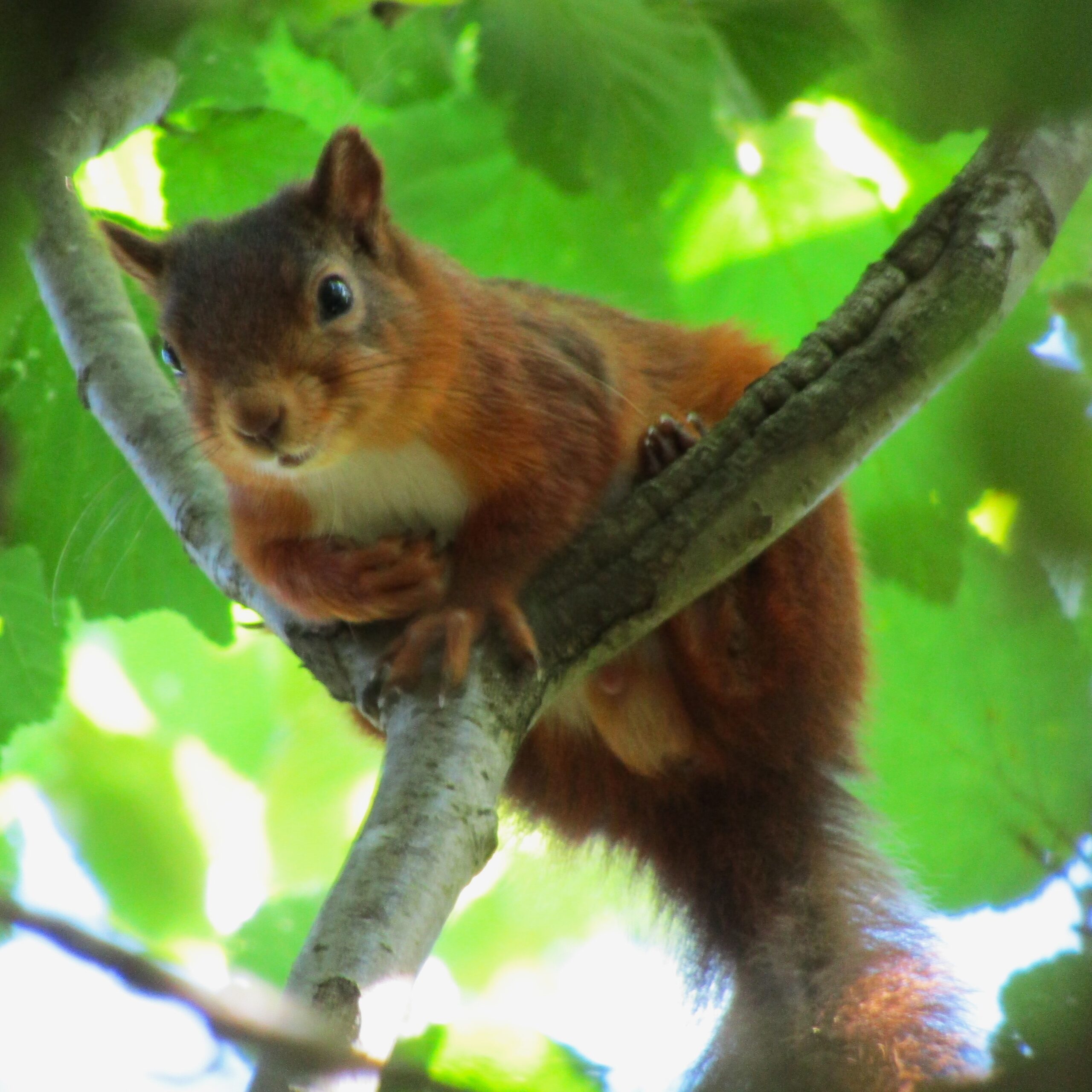
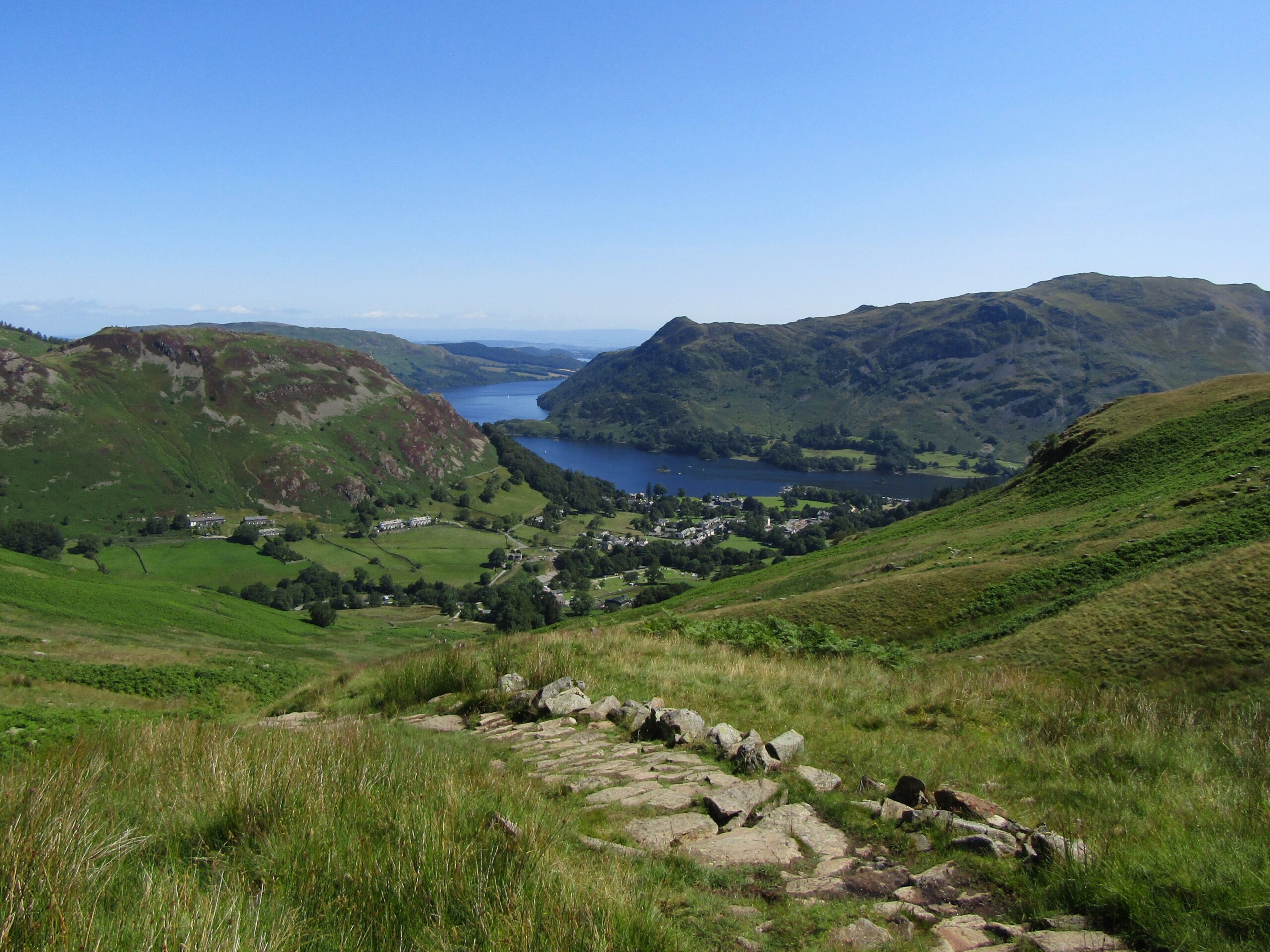
The hike starts at the village of Glenridding, on the edge of Ullswater – the second largest lake in the district. Nearby is a short hike to Aira Force Waterfall, a gentle walk I used as a warmup that morning. It gave my first sighting of the rare red squirrel – The Lake District is one of the last refuges in the UK.
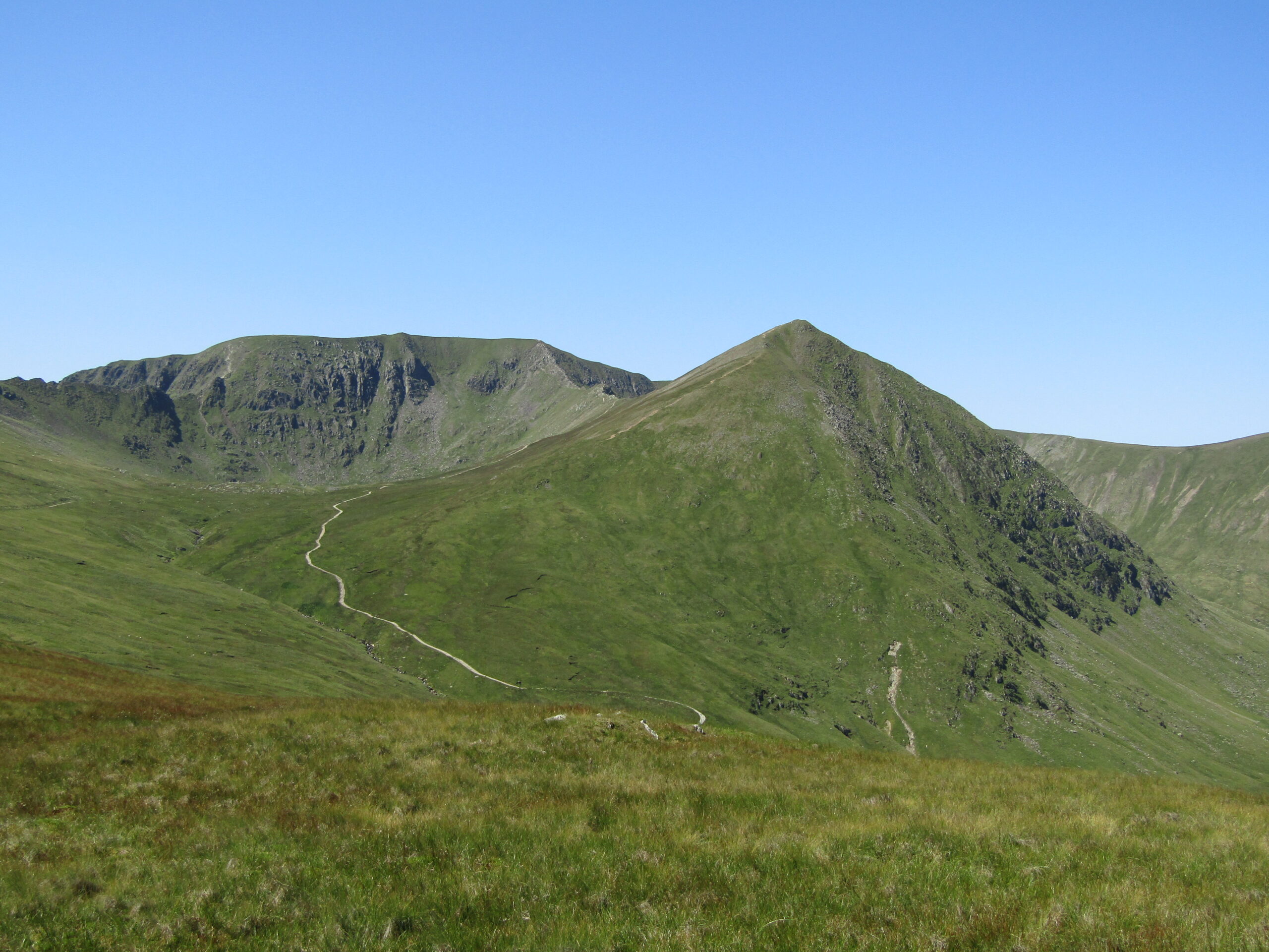
I had the good fortune of clear skies for the day, in what is one of the wettest parts of England. There isn’t a nice way to describe the start of the hike to Helvellyn, other than to tell it as it is. Tough. The path ascends at a steady rate for nearly two miles, on a demanding route. The total elevation on the entire hike was over 1,000 metres – over half of that was on this first slog.
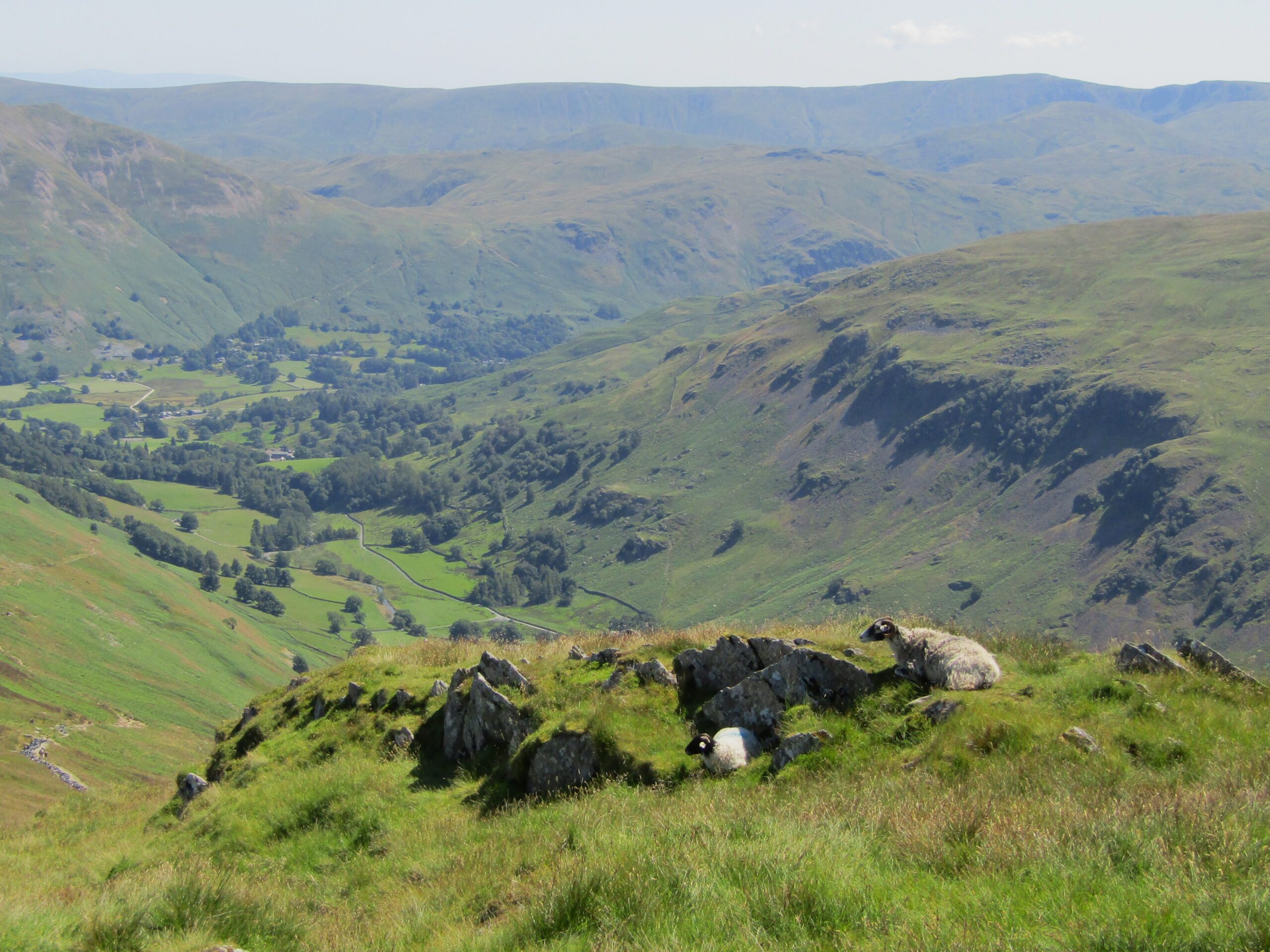
Through fields of sheep, along a dry-stone wall, I climbed. I took heart from the obvious rewards – the views improved on each step, as the elevation allowed expansive views over the area – not least back towards Ullswater, that lay between two slopes.
He paused for a photo before scampering away
Striding Edge
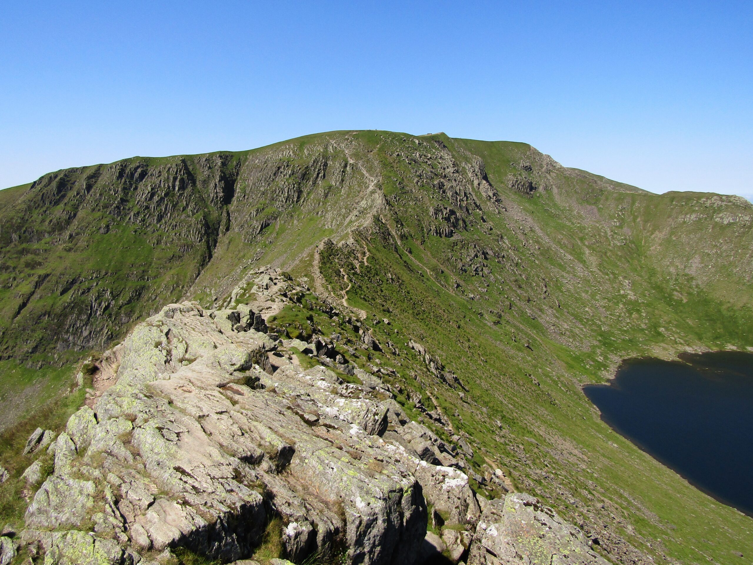
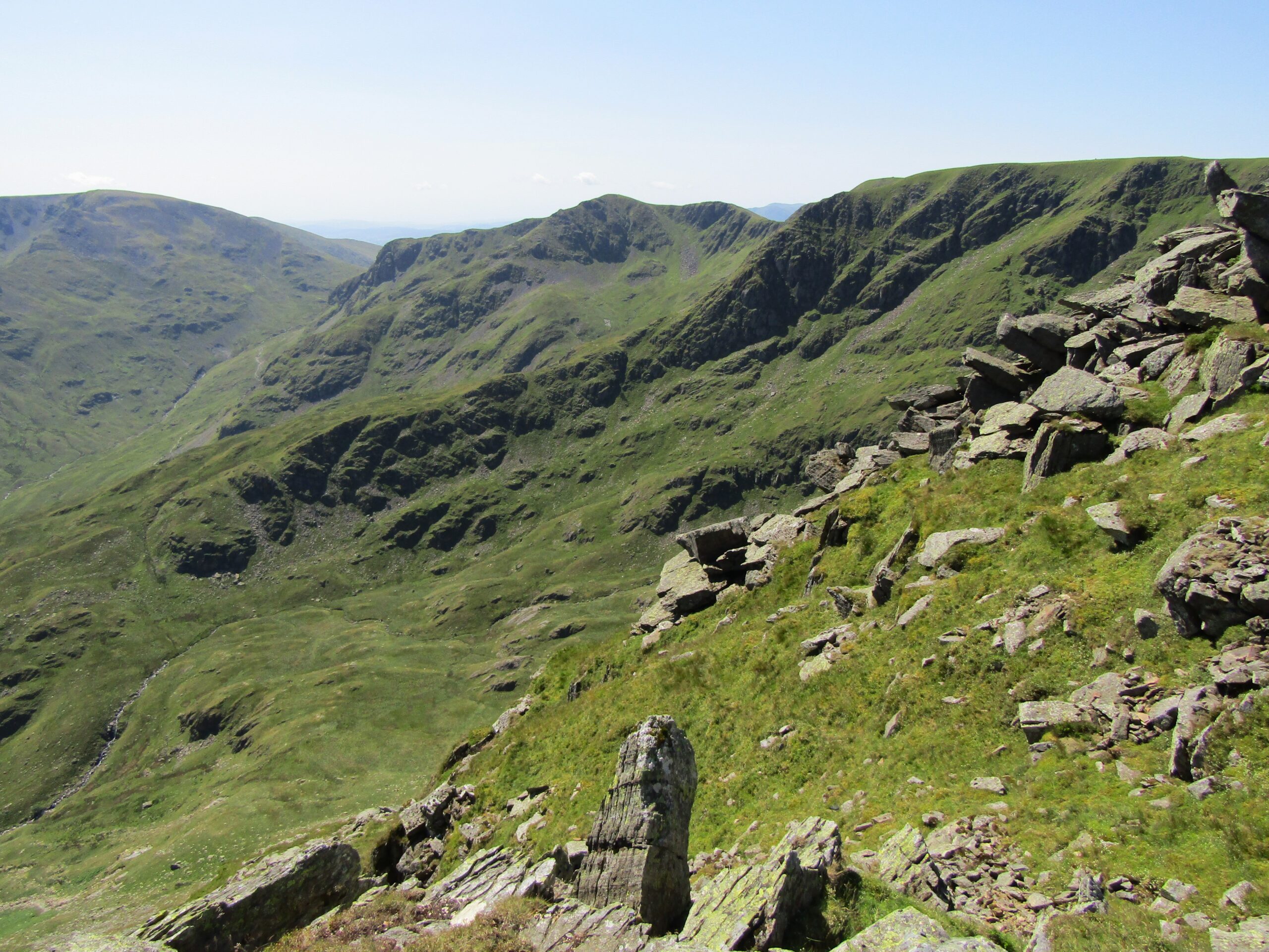
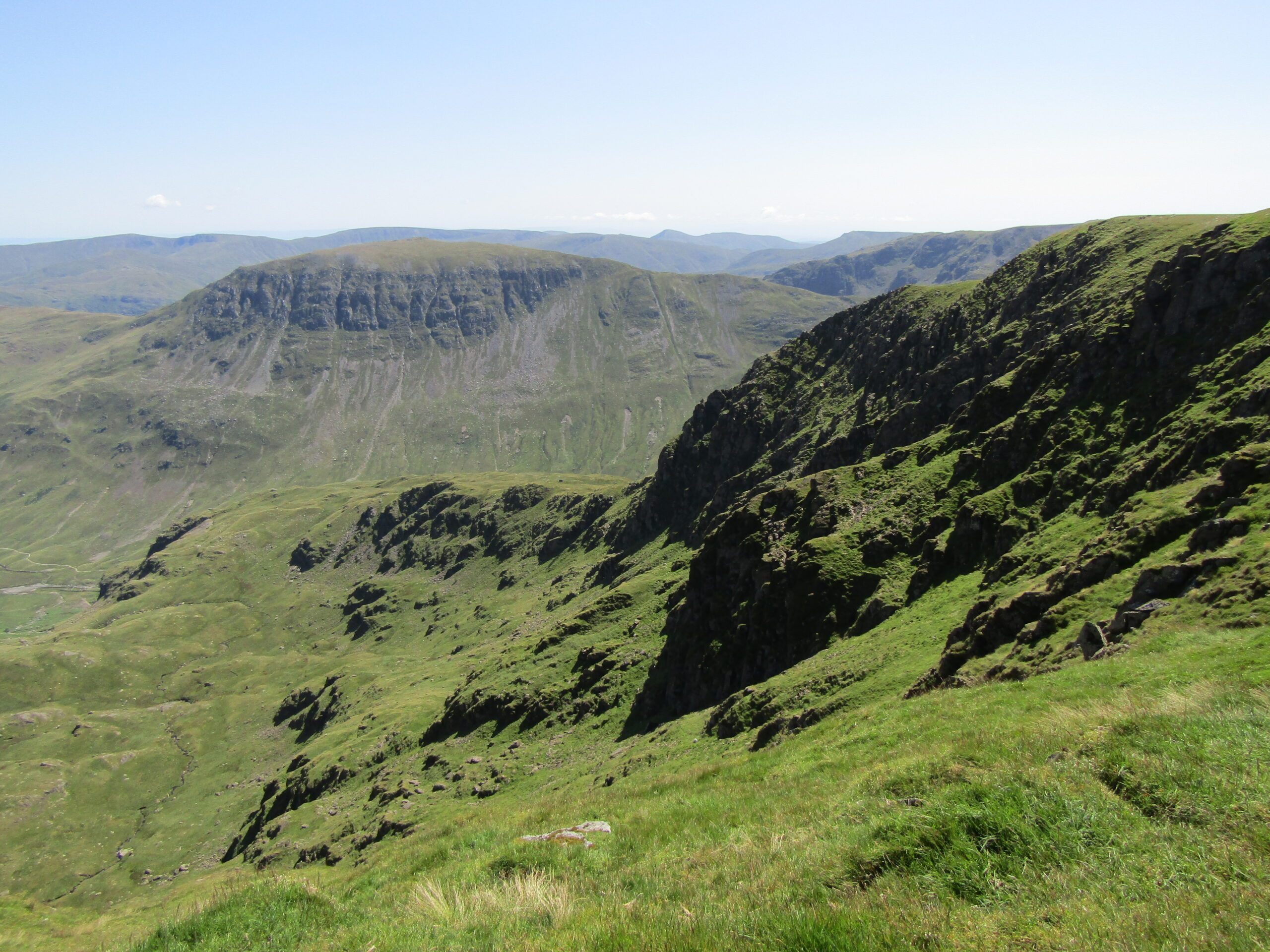
The path levelled out for a moment, before a couple of short, steep inclines brought me to Striding Edge. Striding Edge is the pinnacle of two sleep slopes that meet to create a rocky formation on top. It is a stunning vantage point. To one side is a small lake sitting below the peak. To the other, there is a wide opening lined by jagged cliffs, creating a cauldron below.
To pass required concentration and dexterity. I needed to use both hands and feet to navigate across the stone. This section was more of a scramble than a hike. If all that wasn’t tricky enough, it was only a short fall either side to almost certain death.
I do believe its worth being cautious and not to take risks. Depending on ability and confidence, plus calm weather, I can vouch for it being an enjoyable thrill. I didn’t bemoan my friend for not disclosing the obstacle – at least, not after I made it across.
The approach to Striding Edge
Looking back at Ullswater
Sheep enjoying the view
The cauldron
To the top
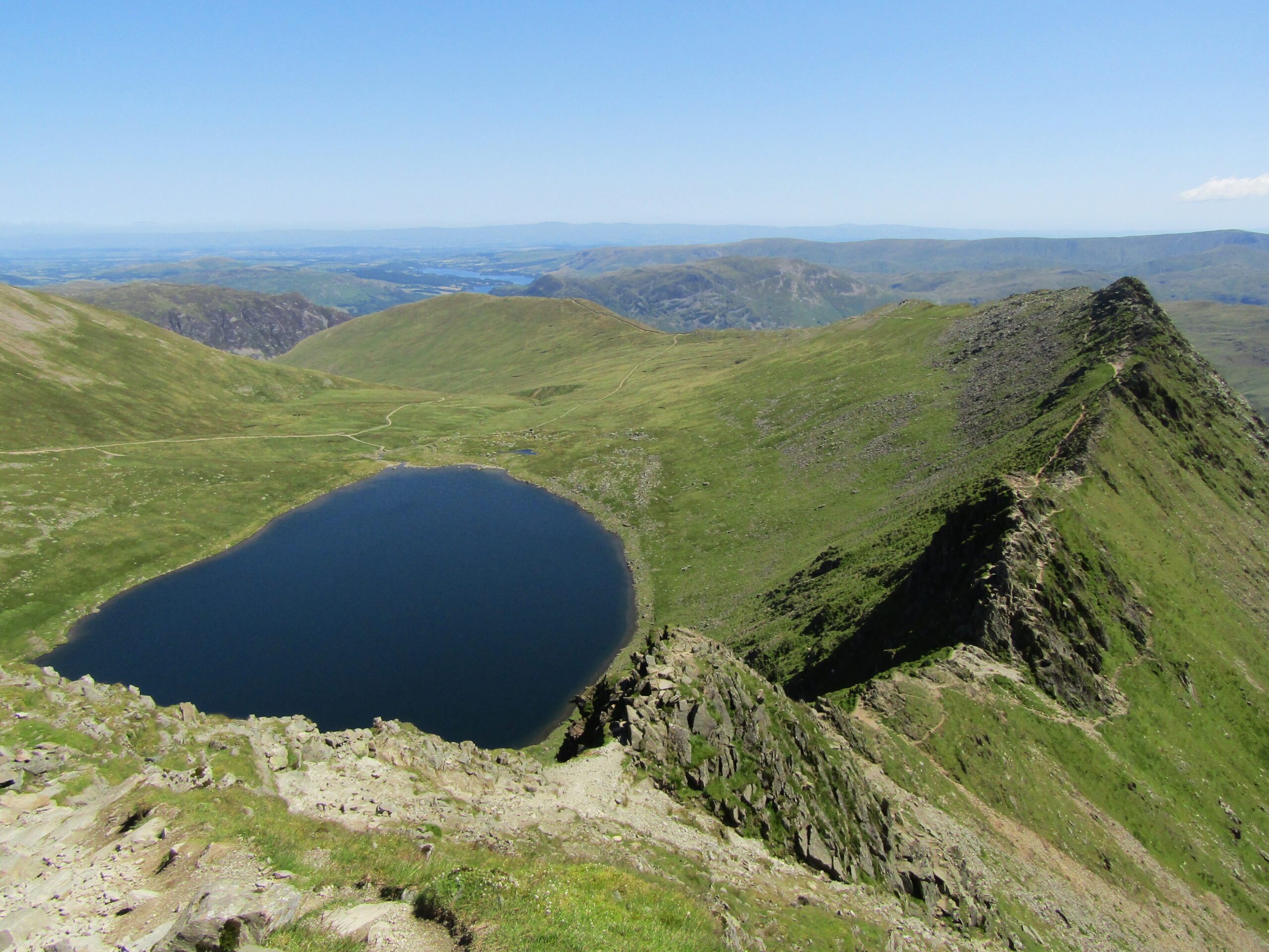
After Striding Edge, rocky steps lead up to the peak. Once there, the view is outstanding. I stood high above the lake that is cradled in the mountainside, and looking back over the path I had travelled lay Ullswater – beyond more ridges and hills – in the distance.
There is a crossroad near the top. To the right, the path circles the summit and then heads back down. Straight on, the path continues up onto a plateau that sits high in the sky. I decided to extend the hike and strolled over the grassy plains. Walking on the elevated plateau, and without protection from the mountainside, I could now feel the full force of the wind.
At the top, above Striding Edge
High in the sky
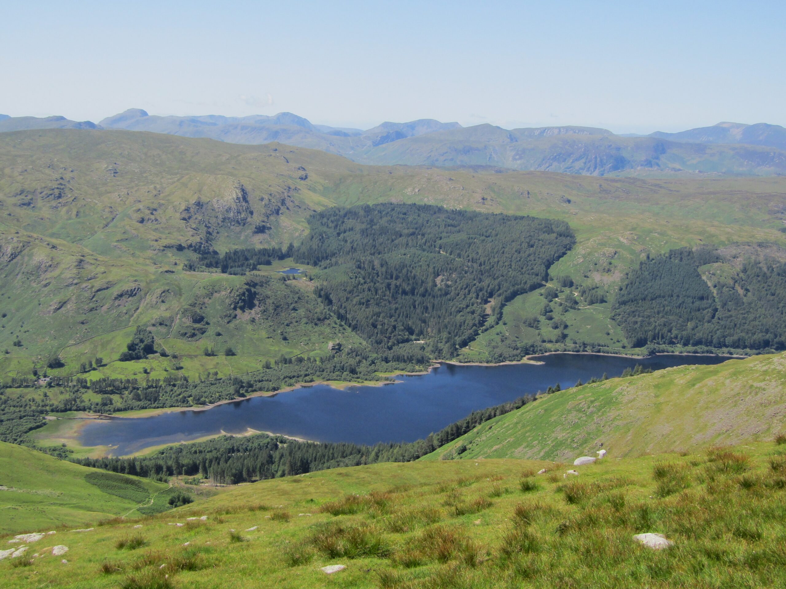
I now had an unobstructed sight across to the centre of the Lake District. I could appreciate how vast this wilderness is. I could also imagine opportunities for multi-day hikes, up and down the countless peaks and valleys. Alas, I only had provisions for a few hours. I did a quick one-mile loop south, above Thirlmere Lake to the west – a lovely setting of water and forest in the valley below.
I stopped for lunch close to the peak of Helvellyn, finding a bit of shelter next to large rocks. I then began the descent down. The trail twists down and around the slopes, with a few steep sections that were tough on the knees. The descent was much less demanding, yet I still felt the exertion from the ascent, as well as the hours spent under the sun.
Thirlmere
The peaks and valleys
Heading back
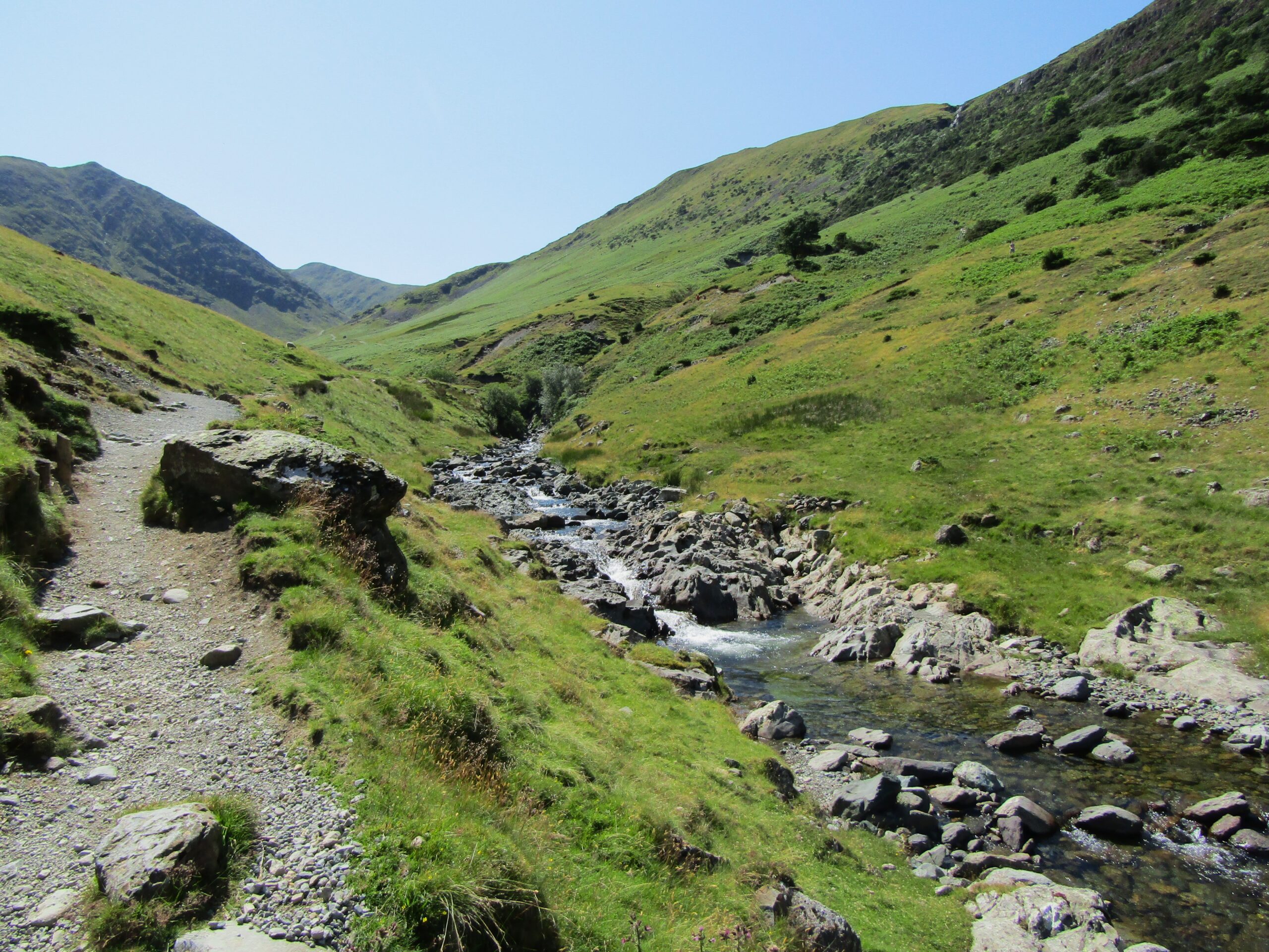
Large parts of the return were on moderate slopes – a mixture of dusty, stony paths, plus some grassy sections. There were a few nice sights to appreciate on the way down, too. A gentle stream followed the path for around a kilometre. Then, towards the end, I enjoyed looking back at the heights I had just conquered.
At a total of ten and a half miles (17km), and a total walking time slightly over four hours, the hike was a decent effort. I can endorse its reputation as a popular single-day hike. It’s accessible yet challenging, with a varied landscape to traverse, and offers very rewarding viewpoints.